Skip to Content
AtlasNova
  • 0
  • 0
  • Contact Us
  • Home
  • Wildlife
  • Space
  • Places
  • History and Culture
  • About Us
AtlasNova
  • 0
  • 0
    • Home
    • Wildlife
    • Space
    • Places
    • History and Culture
    • About Us
  • Contact Us

Why Is the Eye of the Sahara Visible From Space? The Real Science

Why is the Eye of the Sahara visible from space? Discover how millions of years of dome erosion created a giant 25-mile bullseye visible to astronauts.
  • All Blogs
  • Places
  • Why Is the Eye of the Sahara Visible From Space? The Real Science
  • 6 September 2026 by
    Arpit Kaintura
    | No comments yet

    Why Is the Eye of the Sahara Visible From Space?
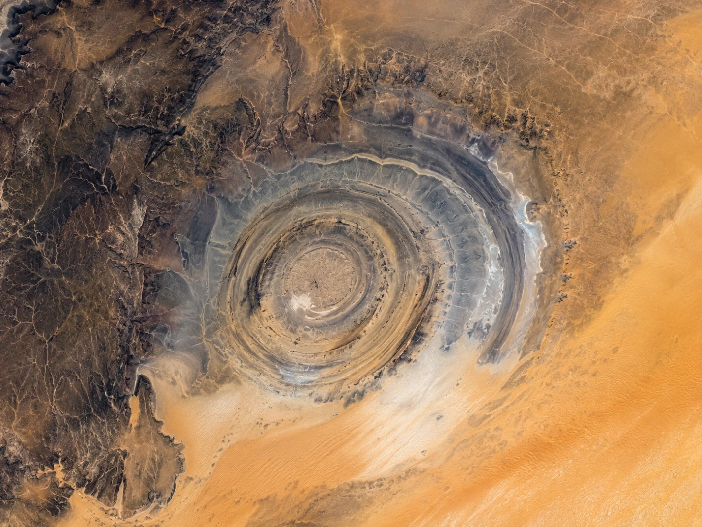
    The Richat Structure forms enormous concentric rings clearly visible from space in the Sahara Desert of Mauritania.

     There is a strange circle in the middle of the Sahara.

    From the ground, it is not easy to understand.

    You see rocks, hills, dry valleys and open desert. Nothing looks particularly eye-shaped.

    Then you look at a satellite image.

    Suddenly, the whole landscape changes.

    A huge series of circles appears across the Mauritanian desert, almost like someone has drawn a giant target on the ground.

    This is the Richat Structure, better known as the Eye of the Sahara.

    It is about 40 kilometres across—so large that a person standing on the ground cannot see its full shape. From space, however, the enormous rings become obvious. NASA describes the structure as a deeply eroded geological dome, while USGS notes that its outer rings extend roughly 40 kilometres across.

    So why can you see an enormous eye from space when it barely looks like an eye from the ground?

    The answer is not that the structure was made to look circular.

    It is that the landscape is huge, the rock layers are arranged in broad rings, and erosion has exposed those layers in a way that makes the pattern visible from above.

    And there is a second part to the story.

    The Sahara itself helps reveal it.


    Chapter 1 — From the Ground, the Eye Almost Disappears
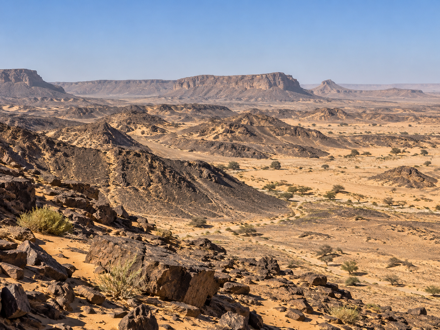
    From ground level, the Richat Structure looks like ordinary rocky desert rather than a giant circular eye.

     Imagine standing inside the Richat Structure.

    You are surrounded by desert.

    There are ridges, exposed rock, dry valleys and broad stretches of sand.

    But you cannot simply look around and see an enormous eye.

    That is because the shape is far too large.

    The Richat Structure is roughly 40 kilometres across.

    A person standing on one side can see only the nearby hills and rocks.

    The curve that looks so obvious from space is spread across the whole landscape.

    It is a little like standing inside a giant circle drawn on a football field.

    From the field, you see the lines near you.

    From high above, you see the whole shape.

    There is something else that makes the Richat Structure difficult to recognize from the ground.

    Its “rings” are not painted lines.

    They are ridges of different rock.

    Some areas rise slightly higher than others. Valleys cut across them. Sand covers parts of the landscape.

    Only from a great distance do all those pieces come together.

    NASA astronauts have photographed the Richat Structure from orbit, and satellite images show its circular pattern much more clearly than ground-level views.

    So the Eye of the Sahara is not really an object that looks like an eye.

    It is a shape created by distance.


    Why You Cannot See the Whole Eye From the Ground

    Detailed infographic explaining why the Eye of the Sahara appears from space. A large side-by-side perspectiva comparison shows on the left a person on the ground, seeing only low rocky ridges, valleys, and sand, unaware of the larger structure. On the right, a view from space reveals the exact same landscape but shows broad circular ridges and multiple concentric rings, making the complete circular pattern immediately obvious. Explanation cards detail that ground level reveals individual features, while space shows how features fit together across nearly 40 kilometres, and that the 'eye' is a landscape-scale pattern, not a giant surface object. The final takeaway is that the eye is easier to see when you can see the whole landscape.
    Geological Perspective

    Why Does the Eye Appear From Space?

    A side-by-side comparison illustrating how the massive scale of the Richat Structure transforms individual rock layers into a broad concentric pattern when viewed from orbit.

    From the ground

    You see individual hills, valleys, and rock layers. Your perspective is limited to the local terrain.

    From space

    You see how those individual features fit together across nearly 40 kilometres, revealing the total pattern.

    The key

    The "eye" is a massive, landscape-scale geological pattern, not a giant object with an eye-shaped surface.

    “The eye is easier to see when you can see the whole landscape.”


    Chapter 2 — The Circles Are Made of Rock
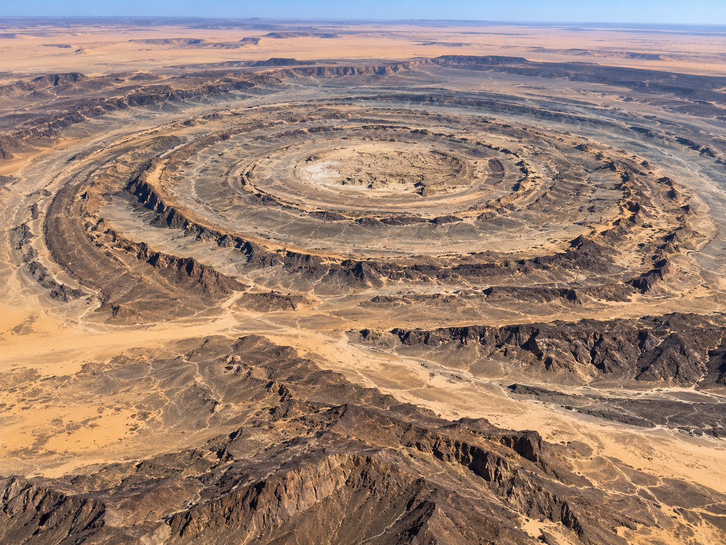
    Eroded rock layers form broad circular ridges across the uplifted dome of the Richat Structure.

     So where did all those rings come from?

    Not from a giant impact.

    Not from an enormous crater.

    And not from someone drawing circles in the desert.

    The Richat Structure is a huge geological dome.

    Deep underground, molten rock once pushed upward into the surrounding rocks. The surface above it was gradually lifted into a broad dome. Geologists call this structure a domed anticline.

    The rocks were not all the same.

    Some were harder.

    Some were easier to erode.

    As millions of years passed, wind and water wore away the exposed dome.

    The softer rocks disappeared more quickly.

    Harder rocks remained as ridges.

    And because the rocks had originally been arranged around the dome, the remaining ridges formed broad circular bands.

    Those are the rings we see from space.

    So the Eye of the Sahara is not a hole in the ground.

    It is almost the opposite.

    It is the leftover shape of a huge uplifted landscape after erosion removed parts of it.

    NASA describes the structure as an eroded geological dome in which different rock types were exposed at the surface.

    The eye was not drawn.

    It was uncovered.


    How the Giant Rings Formed

    Geological infographic titled 'Where Did the Rings Come From?'. Shows three clear sequential stages of the Richat Structure's formation: Stage 1 shows flat sedimentary rock layers pushed upward into a broad dome by an underground magma intrusion. Stage 2 shows wind and rain wearing down the top of the elevated dome. Stage 3 shows differential erosion where soft rock wears away into valleys while hard rock stands out as remaining concentric ridge rings. Four text boxes explain Uplift, Erosion, Different Rock Types, and The Result, concluding with the statement: 'The circles are the remains of an ancient geological dome.'
    Geological Evolution

    Where Did the Rings Come From?

    A clear step-by-step cross-section showing how underground force, broad uplifting, and selective erosion revealed the concentric rings of the Richat Structure.

    1 Underground Uplift
    2 Planar Erosion
    3 Remaining Ridges

    Uplift

    Rock beneath the surface pushed the overlying layers upward into a broad dome.

    Erosion

    Wind and water gradually wore down the elevated dome over millions of years.

    Different Rock Types

    Harder rock resisted erosion better than softer rock, which washed away into valleys.

    The Result

    Remaining ridges follow the original circular structure of the uplifted dome.

    “The circles are the remains of an ancient geological dome.”


    Chapter 3 — Why Are the Rings So Clearly Visible?
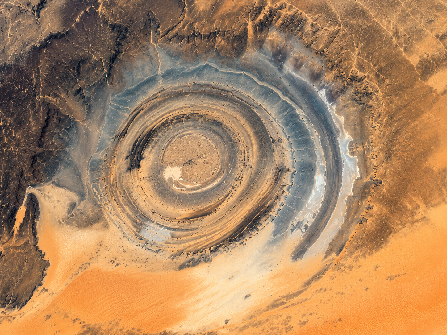
    Contrasting rock colours and exposed ridges make the circular Richat Structure easy to distinguish from the surrounding Sahara.

     Even if the rocks form circles, another question remains.

    Why can you see them so clearly from space?

    Part of the answer is colour.

    The rocks inside the Richat Structure are not all the same.

    There are different sedimentary and igneous rocks, and they weather differently. Those differences create bands of contrasting colour across the landscape. NASA notes that the orange and grey tones in modern satellite views reflect differences in sedimentary and igneous rocks.

    Then there is the desert.

    Sahara sand surrounds the structure, but much of the dome itself remains relatively exposed.

    USGS notes that persistent northeasterly winds help keep parts of the dome free from sand, exposing the different rock layers.

    That gives the satellite a remarkable view.

    Rock.

    Sand.

    Rock.

    Sand.

    Light-coloured ridge.

    Dark ridge.

    Another ridge.

    All arranged in enormous curves.

    You do not have to know anything about geology to notice that something is unusual.

    Your eyes simply follow the pattern.

    That is why the Richat Structure is so good at catching your attention from orbit.

    It is not just circular.

    It is circular and visually contrasted against the desert around it.


    Why the Eye Stands Out

    Educational infographic titled 'Why Is the Eye So Easy to See From Space?'. Features a satellite-style overhead view of the Richat Structure displaying realistic desert sand, concentric rock ridges, and natural rock colors (grey, brown, dark tones) contrasting with surrounding pale sand. Text cards beneath explain that the circular shape follows an ancient dome, different rocks provide natural color contrast, and the open desert keeps the structure exposed rather than buried. A miniature comparison shows a low-contrast landscape where the shape is hard to see versus a high-contrast landscape where it is immediately visible. The final takeaway states: 'The eye is not painted onto the desert. The desert simply makes its geological pattern unusually easy to see.'
    Geological Visibility

    Why Is the Eye So Easy to See From Space?

    An examination of natural surface contrast, ridge topography, and arid desert preservation that make the Richat Structure prominent in orbital photography.

    Circular Shape

    Large ridges follow the structure of the ancient dome, creating wide concentric circles across the terrain.

    Rock Contrast

    Different rocks have different colours and textures, creating natural light and dark bands across the surface.

    Open Desert

    Much of the structure remains exposed rather than hidden by sand dunes or dense vegetation cover.

    Result

    The entire pattern stands out strongly in satellite images against the pale, surrounding desert floor.

    Visual Contrast Comparison

    Low contrast landscape: Circular shape harder to notice due to uniform surface tones.

    High contrast landscape: Circular shape immediately visible due to distinct color variations.

    “The eye is not painted onto the desert. The desert simply makes its geological pattern unusually easy to see.”


    Chapter 4 — It Was Once Thought to Be a Giant Crater
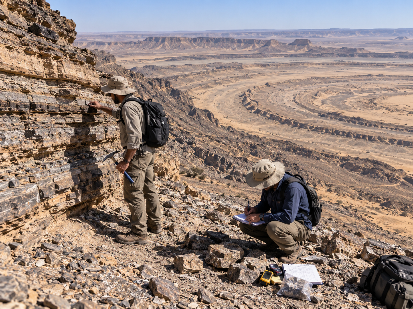
    Geologists examine exposed rock layers in the Richat Structure that helped show it was not a meteor impact crater.

     There was a time when scientists had a very different idea about the Eye of the Sahara.

    Look at it from above.

    It is almost perfectly circular.

    So one obvious possibility was a meteorite impact.

    Large impacts can produce circular structures.

    And the Richat Structure certainly looked like one.

    For a period, it was interpreted as a possible impact crater.

    But as scientists studied the rocks more closely, the evidence did not fit.

    NASA notes that the structure was initially thought to be an impact feature, but geological studies later showed that it is an uplifted dome instead.

    USGS also explains that the structure was once interpreted as an asteroid impact site, but most scientists now conclude that geological uplift created it.

    One important clue was the lack of the kinds of shock effects expected from a large impact.

    The rocks told a different story.

    They had been pushed upward.

    Then they had been eroded.

    Once geologists understood that, the giant crater idea stopped making sense.

    And this is one reason the Eye of the Sahara is such a good geological story.

    Its appearance gives you the wrong first answer.

    You see a circle.

    You think:

    Impact.

    The rocks say:

    Look again.


    Crater or Dome?

    Educational infographic titled 'Was the Eye of the Sahara a Meteor Crater?'. Contains a side-by-side visual geological comparison. On the left, the rejected Impact Crater Model shows a bowl-shaped depression with a central impact point, shocked rock zone, deep crater bowl, and surrounding ejected debris. On the right, the accepted Richat Structure Model shows a broad uplifted geological dome with layered rock pushed upward, soft rock eroded away, remaining circular quartzite ridges, and a deep igneous intrusion underneath. Three evidence cards explain why it initially looked like a crater, why scientists changed their minds based on geological field evidence, and the current accepted explanation. The final verdict confirms it is not a giant meteor crater, but an ancient geological dome shaped by uplift and erosion.
    Geological Evaluation

    Was the Eye of the Sahara a Meteor Crater?

    A comparative structural analysis weighing the impact crater hypothesis against the field-validated uplifted and eroded dome model.

    Impact Crater Model

    Hypothesis Disproved

    Richat Structure Model

    Scientific Consensus

    Why it looked like a crater

    Its enormous circular shape and central depression originally seemed strikingly similar to known planetary impact structures when first observed from orbit.

    Why scientists changed their minds

    Field studies revealed a total absence of impact evidence—no shock-metamorphosed quartz, no shatter cones, no melt sheet, and no high-pressure mineral polymorphs.

    Current explanation

    The Richat Structure is a deeply eroded geological dome created by a Cretaceous-era igneous intrusion pushing strata upward, followed by millions of years of differential erosion.

    Not a giant meteor crater.

    An ancient geological dome shaped by uplift and erosion.


    Chapter 5 — It Is Nearly 40 Kilometres Across
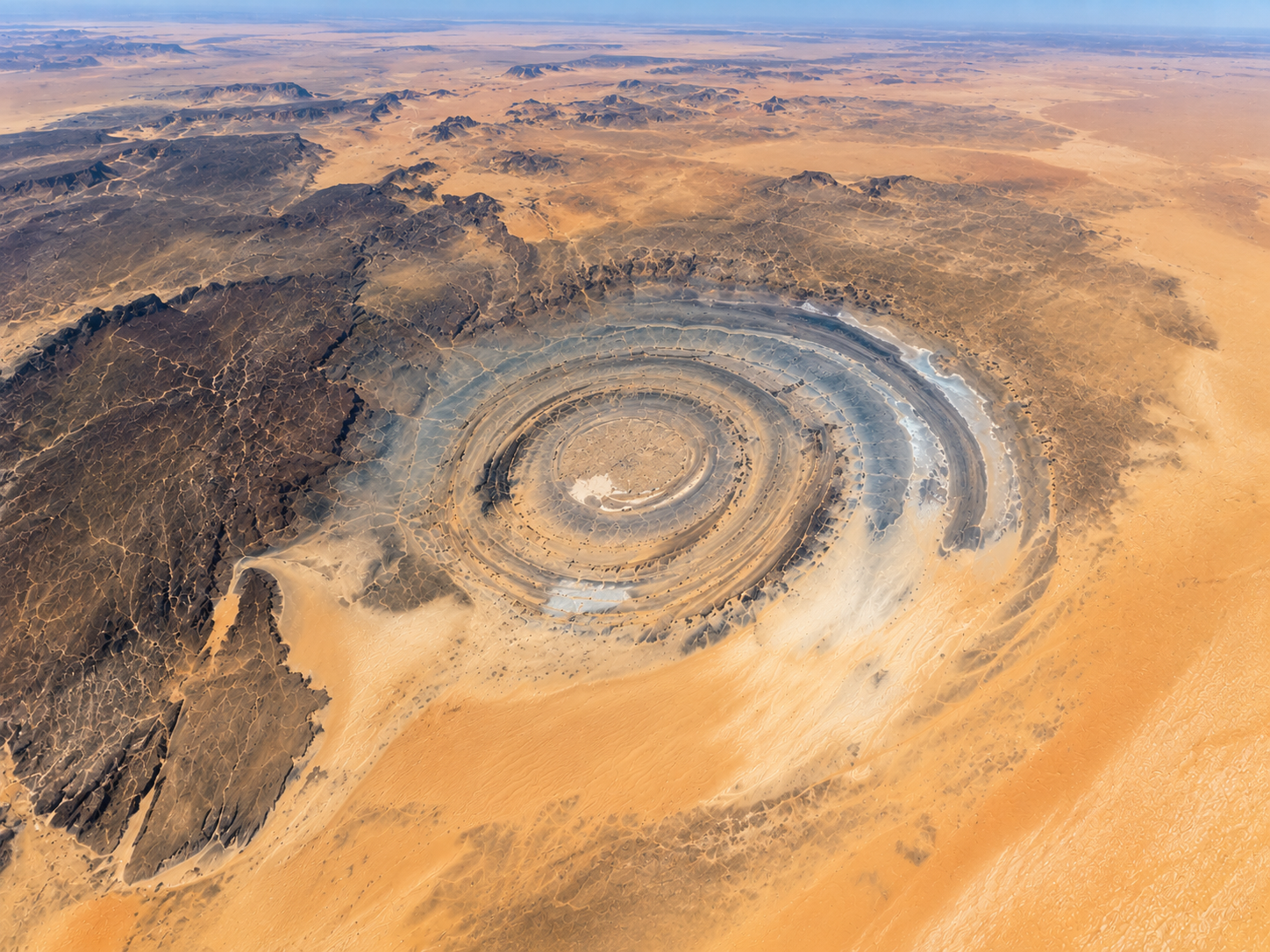
    The roughly 40-kilometre-wide Richat Structure spreads across an open section of the Sahara.

     Now imagine how large the Eye of the Sahara really is.

    About 40 kilometres.

    That is roughly the width of a large city.

    But there is no giant wall marking the edge.

    No single cliff announces:

    “You have reached the Eye.”

    The structure simply spreads through the desert.

    That enormous size is one reason it is so difficult to understand from the ground.

    NASA's 2026 Earth Observatory description gives the structure a width of about 40 kilometres, while the USGS also describes its outermost rings as approximately 40 kilometres across.

    From space, however, that size becomes an advantage.

    The larger the structure, the more of its circular pattern a satellite can see at once.

    And the Richat Structure sits in an open desert landscape.

    There are no skyscrapers.

    No forests.

    No large cities covering parts of the view.

    Just rock and sand.

    The eye has room to show itself.

    That is one reason satellites can recognize the pattern so easily.

    The structure is enormous.

    The desert around it is relatively open.

    And the rings stretch across the landscape in every direction.


    Chapter 6 — The Sahara Helps Reveal It
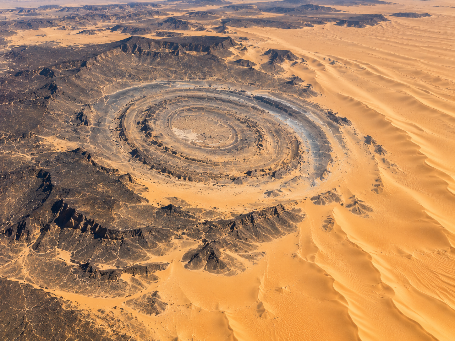
    Exposed rock ridges remain visible among Sahara dunes around the Richat Structure.

     There is something else working in the Eye's favour.

    The desert itself.

    The Sahara contains enormous fields of moving sand, but the Richat Structure is made of exposed rock and ridges.

    Persistent northeasterly winds help keep much of the dome relatively free of sand, allowing its different rock layers to remain visible.

    That makes the structure stand out.

    Imagine covering a black-and-white pattern with a thick layer of sand.

    The pattern disappears.

    Remove much of the sand.

    The pattern returns.

    Something similar happens here.

    Wind moves sand around the surrounding landscape while the harder rock of the structure remains exposed.

    The desert is therefore not hiding the Eye.

    In an unexpected way, it helps display it.

    And there is a nice connection here.

    The Eye of the Sahara is visible because of both geology and erosion.

    The geological forces created the shape.

    Erosion uncovered it.

    Wind and weather continue to modify the surface.

    What we see from space is not a frozen drawing.

    It is the exposed remains of a much older landscape.


    Why the Desert Does Not Hide the Eye

    Educational infographic titled 'How Does the Eye Stay Visible Through the Sahara?'. The main satellite-style diagram shows a top-down view of the Sahara desert with wind-blown dune fields, exposed circular rock ridges of the Richat Structure, and sand accumulating outside and between valleys. Subtle curved arrows represent prevailing wind movement sweeping loose sand along. Four explanation cards clarify: Wind moves loose sand across the landscape; Rock ridges remain exposed; Contrast between dark rock and pale sand highlights the structure; and Result keeps the pattern distinct. A miniature before and after comparison shows how 'More sand' partly hides the pattern versus how 'More exposed rock' makes the pattern clearer. The final takeaway reads: 'Erosion did not create the original dome. It helped reveal the shape we can see today.'
    Desert Geology & Dynamics

    How Does the Eye Stay Visible Through the Sahara?

    An examination of wind action, active sand transport, and topographic resistance that keep the ancient geological rings exposed in an active desert environment.

    Wind

    Persistent trade winds constantly move loose sand particles across the open Saharan plateau landscape.

    Rock

    The elevated quartzite ridges of the Richat Structure remain exposed, resisting total sand burial.

    Contrast

    Dark bare rock ridges and pale windblown sand in intervening valleys look starkly different from above.

    Result

    The broad circular geological pattern stays clearly exposed and easy to distinguish from orbit.

    Sand Cover vs. Structural Visibility

    More sand: Pattern is partly buried and hidden under heavy dune accumulation.

    More exposed rock: Persistent wind clears ridges, making the circular pattern sharply visible.

    “Erosion did not create the original dome. It helped reveal the shape we can see today.”


    Chapter 7 — The “Eye” Was Not Made for Space
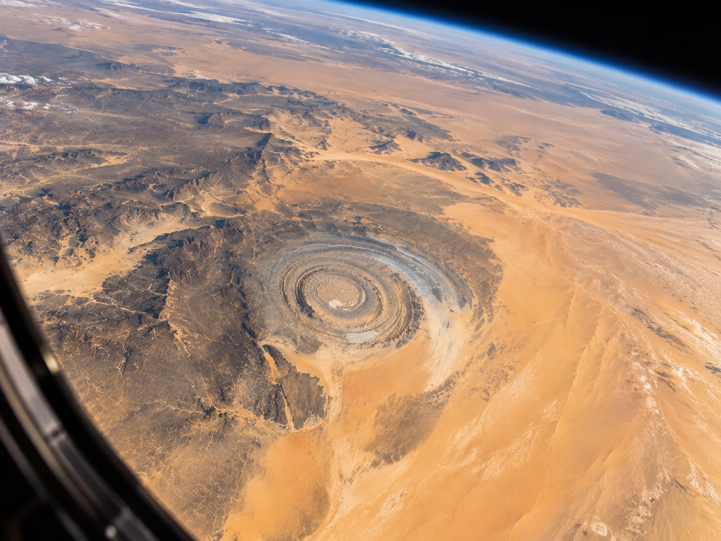
    : The Richat Structure appears as a giant circular pattern in the Sahara when viewed from low Earth orbit.

     There is an amusing part of the story.

    The Richat Structure looks as though it was designed for someone looking down from orbit.

    It was not.

    The rocks were formed and lifted long before satellites existed.

    Erosion slowly shaped the exposed dome.

    Wind and water continued to remove material.

    The Sahara spread around it.

    And then, much later, humans finally went high enough to see the entire structure at once.

    NASA notes that astronauts Ed White and James McDivitt helped bring global attention to the Richat Structure after photographing it during the Gemini IV mission.

    That is when the nickname “Eye of the Sahara” really began to make sense to a global audience.

    From the ground, it is a strange collection of hills and rocks.

    From hundreds of kilometres above Earth, the pieces suddenly become one enormous pattern.

    That tells us something interesting about landscapes.

    Some features are obvious only when you change your distance from them.

    A valley makes sense from a hillside.

    A coastline makes sense from a plane.

    The Richat Structure makes sense from space.

    The landscape was always there.

    What changed was our view of it.


    One Landscape, Three Views

    Infographic titled 'The Eye Depends on Perspective'. It features three progressively higher visual views of the Richat Structure without text inside the drawings. View 1 from the Ground shows close-up rock ridges, valleys, and sand dunes where the circular pattern is impossible to discern. View 2 from High Altitude shows large curving ridge lines beginning to reveal a connected formation. View 3 from Space shows the complete concentric circular structure of the Eye of the Sahara. Three text boxes below describe Ground, High Altitude, and Space perspectives. A historical card notes Gemini 4 in 1965, where astronaut photography brought the structure to global attention. The final takeaway states: 'The landscape did not change. Our view did.'
    Observational Geology

    The Eye Depends on Perspective

    How scale and elevation transform an apparently random landscape of desert ridges into one of Earth's most recognizable geological formations.

    Ground View

    Individual rocks and ridges dominate the view. At ground level, the terrain appears as an ordinary series of desert cliffs, valleys, and sand dunes.

    High Altitude View

    Large curves begin to connect. From an aircraft, distant ridge lines align into sweeping arcuate formations that hint at a broader geometric structure.

    Space View

    The full pattern becomes obvious. From low Earth orbit, the entire 40-kilometer concentric bullseye is immediately visible as a single unified feature.

    Historical Context

    1965 — Gemini IV

    Astronaut photography from the Gemini IV mission first captured the immense scale of the Richat Structure, bringing its striking circular pattern to worldwide scientific and public attention.

    “The landscape did not change. Our view did.”

    Frequently Asked Questions


    1. Why is the Eye of the Sahara visible from space?

    The Richat Structure is roughly 40 kilometres across and contains broad, concentric rock ridges with strong colour and texture differences. Its enormous size and the open desert around it make the circular pattern much easier to see from above.

    2. What is the Eye of the Sahara?

    The Eye of the Sahara is the common name for the Richat Structure, a huge geological formation in Mauritania. It is an eroded, uplifted dome made of different layers of rock.

    3. How big is the Richat Structure?

    The structure is about 40 kilometres across. Its enormous size is one reason the complete circular pattern is difficult to recognize when you are standing inside it.

    4. How did the Eye of the Sahara form?

    Geologists believe the Richat Structure formed when rocks were pushed upward into a broad dome and were later worn down by erosion. Different rocks resisted erosion at different rates, leaving the circular ridges visible today.

    5. Is the Eye of the Sahara a meteorite crater?

    No. It was once considered a possible impact structure because of its circular shape, but geological studies found that the evidence fits an uplifted and eroded dome much better.

    6. Why does the Richat Structure have so many circles?

    The circles are broad ridges formed by different rock layers within the original dome. As softer rocks eroded more quickly and harder rocks remained, the layered structure became visible as rings.

    7. Why can't you see the Eye of the Sahara clearly from the ground?

    The entire structure is enormous. From ground level, you see individual ridges, valleys and rocks rather than the complete pattern. The circular shape becomes obvious only when you can see a much larger area at once.

    8. Why are the rings different colours?

    The Richat Structure contains different types of sedimentary and igneous rocks. Their natural colours and textures differ, creating the contrasting bands that make the circular pattern stand out against the surrounding Sahara.

    9. When was the Eye of the Sahara discovered?

    The structure became widely known outside the region after it was photographed from space. Astronaut photography during NASA's Gemini IV mission in 1965 helped draw international attention to the formation.

    10. Why is it called the Eye of the Sahara?

    From high above, the concentric ridges resemble a giant eye or target in the desert. The nickname describes its appearance from a distance; the geological formation itself is known as the Richat Structure.


    in Places
    Arpit Kaintura 6 September 2026
    Share this post

    Share

    Tags
    Our blogs
    • Our blog
    • Wildlife
    • Space
    • Places
    • History and Culture
    Archive
    Sign in to leave a comment
    Why Does Venezuela Experience So Much Lightning at Catatumbo?
    Why does Catatumbo produce so much lightning? Discover how Lake Maracaibo, warm air, mountain winds and thunderstorms create this rare phenomenon.
    Helpful Links
    • Home
    • About us
    • Privacy Policy
    • Contact us
    About us

    Welcome to Atlasnova, my personal website where I share interesting discoveries about space exploration, the solar system, world wildlife. My goal is to make space and wildlife easy to explore and fun to learn for curious minds everywhere. 

    Connect with us
    • Contact us
    • arpitkaintura2025@gmail.com

    Copyright © Atlasnova
    Powered by Odoo - The #1 Open Source eCommerce