Introduction
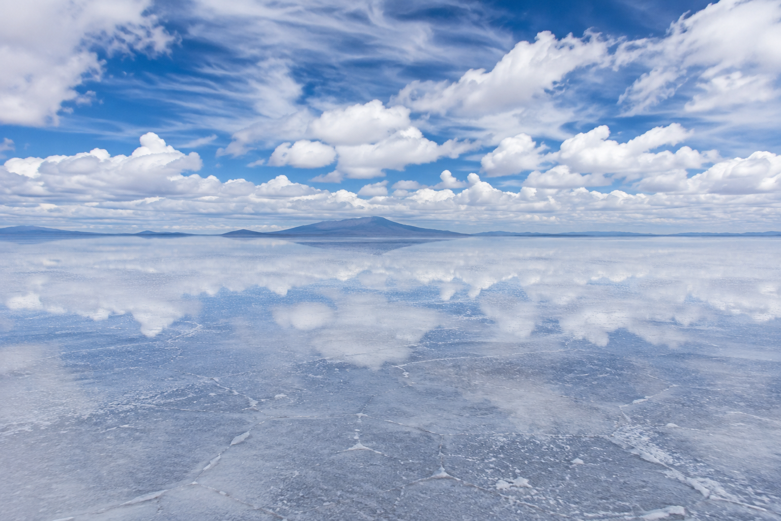
In southwestern Bolivia, the land seems to disappear into the horizon.
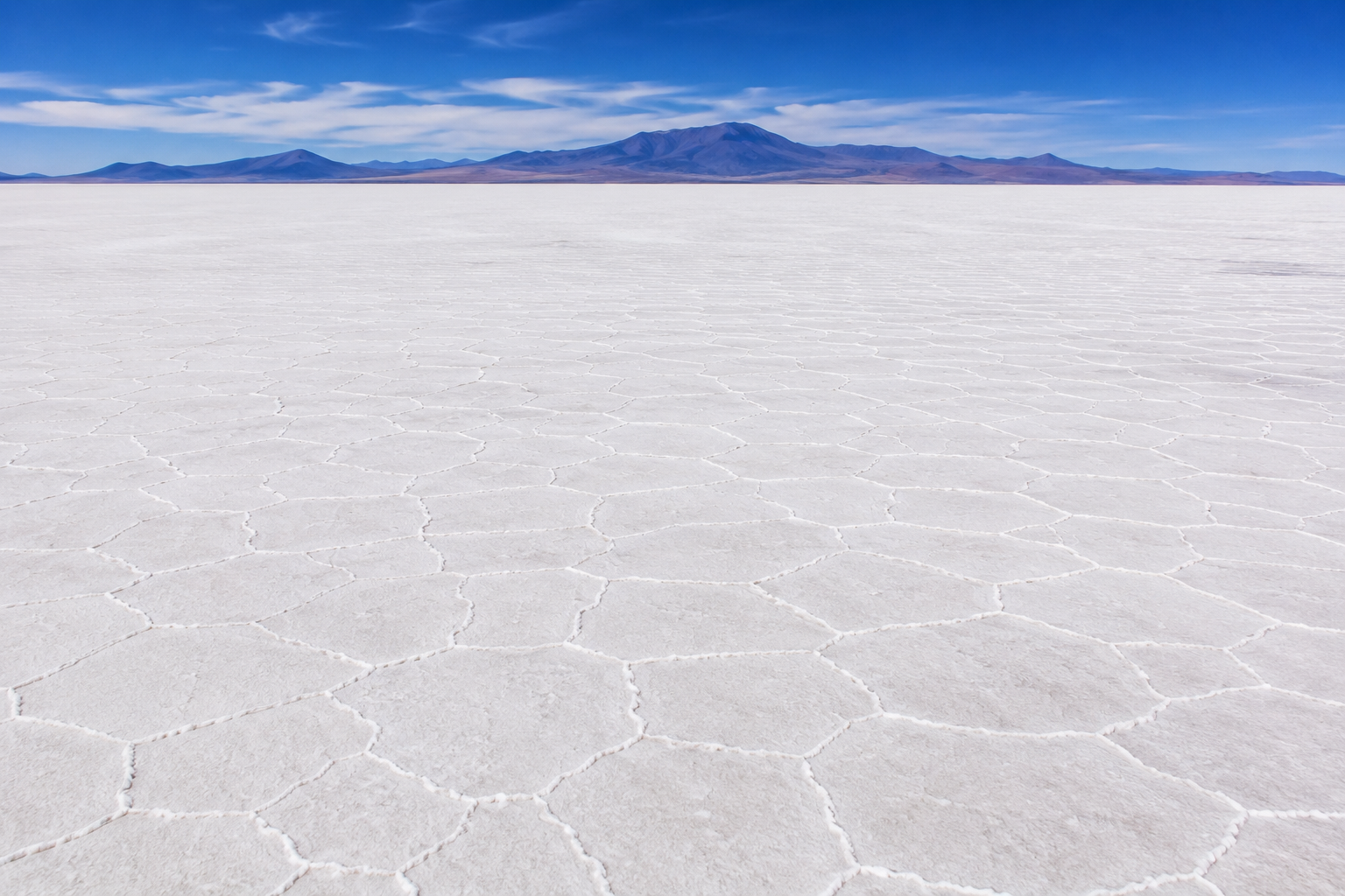
Stretching across roughly 10,000 square kilometers, the Salar de Uyuni is the world's largest salt flat. Its surface is so vast and remarkably flat that, during the dry season, it can look like an endless white plain reaching toward the distant Andes.
But when rain covers the salt with a thin layer of water, the landscape changes completely.
The boundary between earth and sky begins to disappear.
Clouds seem to float beneath your feet. Mountains appear to rise from their own reflections. The horizon becomes difficult to find.
For a short time, the world's largest salt flat can look like an enormous mirror.
Yet the mirror is only one part of the story.
Beneath that brilliant surface lies the remains of an ancient landscape shaped by disappearing lakes, evaporation and mineral deposits. Around it are high-altitude lagoons, flamingos, giant cacti and communities that have lived with the salt for generations.
And far beneath the surface lies another reason the Salar has become globally important: lithium-rich brines that have made this remote landscape part of the modern race for battery resources.
The Salar de Uyuni is therefore more than a spectacular photograph.
It is a geological archive, an extreme ecosystem, a source of livelihoods and one of the world's most unusual landscapes.
To understand how it became this vast white expanse, we have to go back to a time when water covered much of the Altiplano.
Long before the mirror appeared, there were ancient lakes.
Chapter 1 — How the World's Largest Salt Flat Formed
A Landscape Shaped by Ancient Water
The Salar de Uyuni looks almost impossibly simple today: a vast white surface stretching toward the horizon.
But it was not always dry.
The salt flat lies on the Altiplano, a high plateau surrounded by the Andes. Over thousands of years, this region experienced major changes in water levels and climate.
Ancient lakes repeatedly expanded and contracted across the basin.
As the climate became drier, water evaporated.
The minerals dissolved in that water did not simply disappear with it.
They remained behind.
Over long periods, repeated cycles of flooding, evaporation and sediment deposition gradually helped create the enormous salt crust that covers the basin today.
From Ancient Lakes to a Salt Desert
The modern Salar is the result of a much longer geological story than a single lake simply drying up.
The region has experienced several ancient lake phases, including Lake Minchin and later Lake Tauca. Their histories are reconstructed from geological evidence such as sediments, shorelines and other deposits preserved across the Altiplano.
As these large bodies of water repeatedly expanded and retreated, they left minerals behind.
The process was especially important because the basin has no normal outlet to the sea.
Water entering the basin could eventually evaporate, while dissolved minerals accumulated.
Over immense spans of time, this helped produce the thick evaporite deposits associated with the Salar de Uyuni.
The salt is not simply a thin layer sitting on ordinary ground.
Beneath the surface are layers of salt and sediment, with brine occupying spaces within the deposits.
In some parts of the Salar, the salt crust is several meters thick, although its thickness varies across the basin.
That variation is another reminder that the Salar is not a perfectly uniform slab of salt.
It is the visible surface of a much deeper geological system.
Why Is It So Flat?
One of the most extraordinary features of the Salar is not its salt.
It is its flatness.
Across the enormous basin, evaporation and repeated deposition helped create a remarkably level surface.
The result is so flat that the Salar is used for satellite calibration and other scientific measurements requiring an exceptionally broad, level surface.
The scale makes the effect difficult to appreciate from ground level.
Standing on the Salar, there may be no obvious feature separating one part of the landscape from another.
The horizon stretches away in every direction.
And when rain later covers that exceptionally flat surface with a thin film of water, the geological feature that took thousands of years to form becomes the foundation for one of Earth's most extraordinary natural reflections.
But first, there is another clue to the Salar's formation beneath the surface.
It is not just salt.
A Hidden Layer Beneath the White Surface
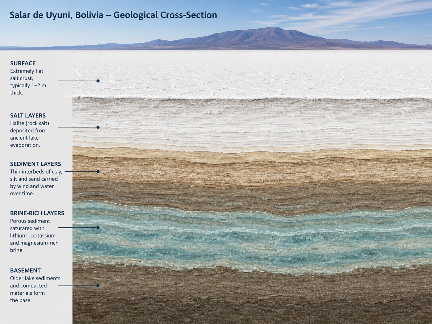
The bright crust that visitors see is only part of the Salar.
Below it are layers of salt, sediment and highly saline brine.
The brine contains dissolved minerals, including significant concentrations of lithium.
This hidden material is one reason the Salar is important far beyond tourism.
The same geological processes that helped create this extraordinary landscape also concentrated minerals within the basin.
That connection becomes important later in the story.
For now, the essential point is simple:
The white surface is the result of an ancient hydrological and geological history—and the landscape beneath it is still active in the sense that water, salt and minerals continue to interact.
The Beginning of the Mirror
The Salar's geological history explains why the surface is so unusual.
Its enormous size and remarkable flatness create the perfect stage for something that happens only under the right conditions.
During the rainy season, water can spread across portions of the salt flat in an extremely thin layer.
Because the surface is so flat, that water can behave almost like a giant sheet of glass.
The salt does not become a mirror because it has some unusual reflective property.
The reflection comes from water covering an exceptionally flat surface.
When the sky, clouds and distant mountains are reflected in that shallow water, the boundary between landscape and sky becomes difficult to distinguish.
The result is the phenomenon that has made Salar de Uyuni famous around the world.
The world's largest salt flat becomes a mirror.
And the science behind that transformation is simpler—and more beautiful—than the photographs might suggest.
Chapter 2 — The Mirror Effect
When the Ground Reflects the Sky
For most of the year, Salar de Uyuni is a vast white expanse.
Then the rains arrive.
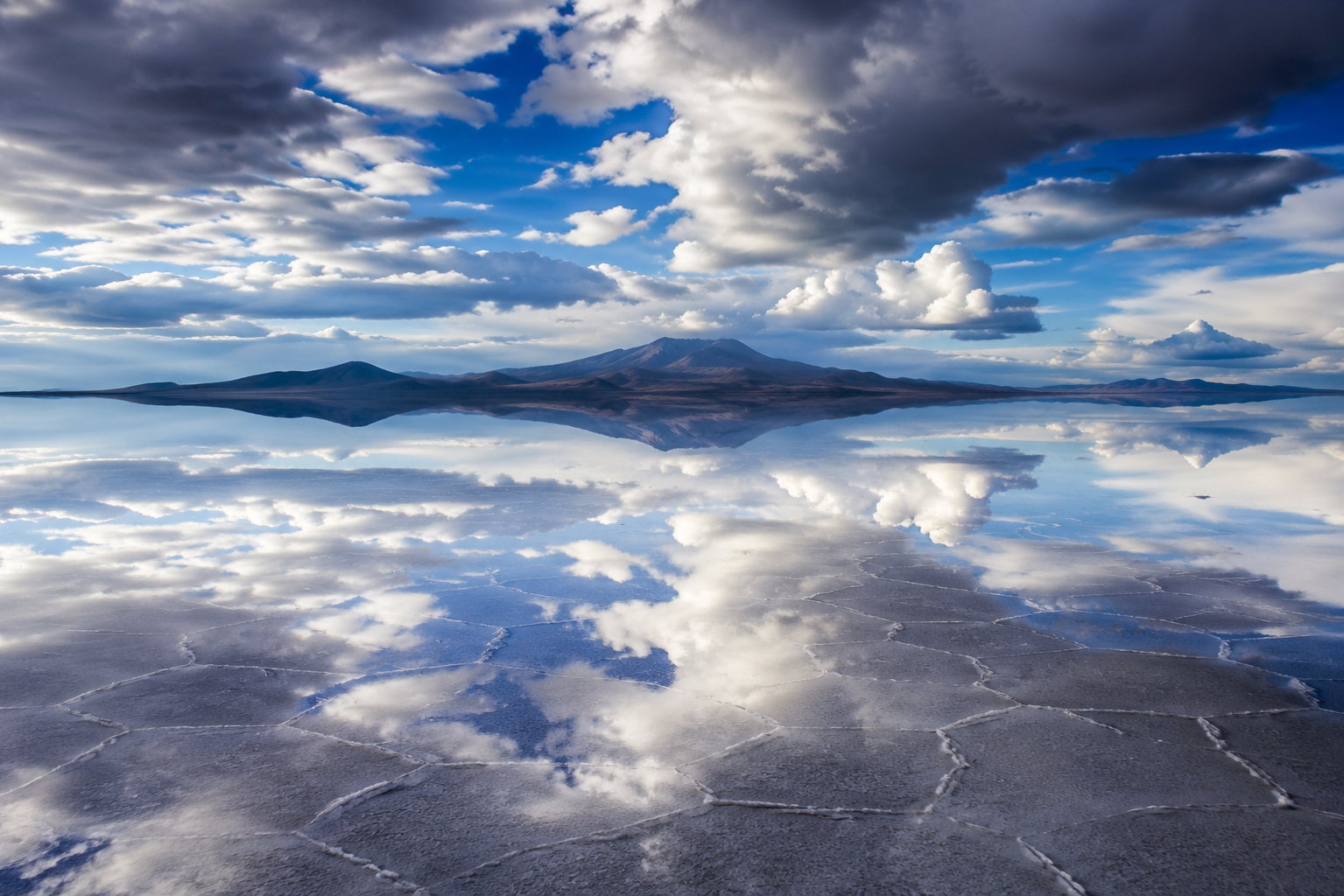
During the wet season, water can collect across the exceptionally flat salt crust. Because the Salar has very little surface relief and poor drainage, rainfall can spread into a shallow sheet across parts of the flat.
The salt itself is not suddenly becoming reflective.
It is the water that creates the mirror.
When that thin layer of water remains smooth, light from the sky reflects from its surface. Clouds, mountains and sunlight can appear beneath your feet, making the horizon almost impossible to distinguish.
The effect can be extraordinary.
Why the Reflection Can Be So Clear
A mirror effect needs more than rain.
The water must remain sufficiently smooth.
That is where the Salar's extraordinary flatness becomes important. Scientific measurements show that the surface has very little topographic variation, allowing water to spread across it with remarkable uniformity.
When the water surface is smooth, light is reflected in a more organized way rather than being scattered in many directions.
The result is a specular reflection—the same basic optical principle behind the reflection you see from a calm lake.
The difference is scale.
At Salar de Uyuni, the reflective surface can extend across an enormous portion of the world's largest salt flat.
That is what makes the familiar photographs look almost impossible.
The Mirror Does Not Appear Every Time It Rains
There is another misconception worth clearing up.
The entire Salar does not automatically become a perfect mirror whenever it rains.
The amount and distribution of water vary.
Rainfall can be uneven, and the flooded area changes with weather and evaporation. Recent satellite observations have shown substantial variation in how much of the Salar becomes covered and how smooth the water surface becomes from one season to another.
So the famous mirror is a temporary condition, not the permanent appearance of Salar de Uyuni.
That is why photographs from the wet season can look completely different from photographs taken only a few months later.
From Mirror to Mosaic
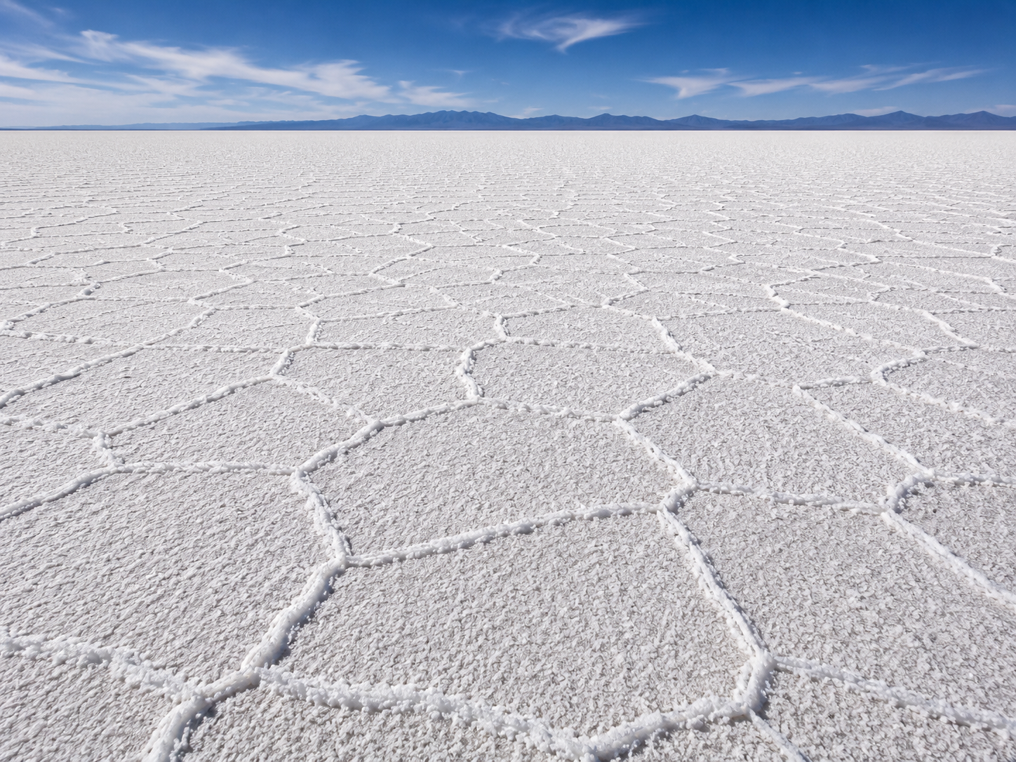
When the water disappears, another pattern emerges.
The white surface develops a network of polygonal shapes—often appearing almost like enormous tiles stretching toward the horizon.
These patterns form as the salt crust responds to evaporation, crystallization and processes occurring within the shallow porous material beneath the surface. Scientific studies of salt playas show that these polygonal patterns are a natural feature of evaporating salt environments.
The result is almost the complete opposite of the wet-season landscape.
Wet: sky reflected across a smooth surface.
Dry: geometric salt polygons stretching across white ground.
The Science Behind the Illusion
Chapter 3 — Life in an Extreme Landscape
Life Beyond the Salt
At first glance, Salar de Uyuni looks almost completely lifeless.
The salt crust stretches for kilometres with little vegetation in sight. The environment is extremely salty, dry and high above sea level.
Yet life exists around this vast landscape.
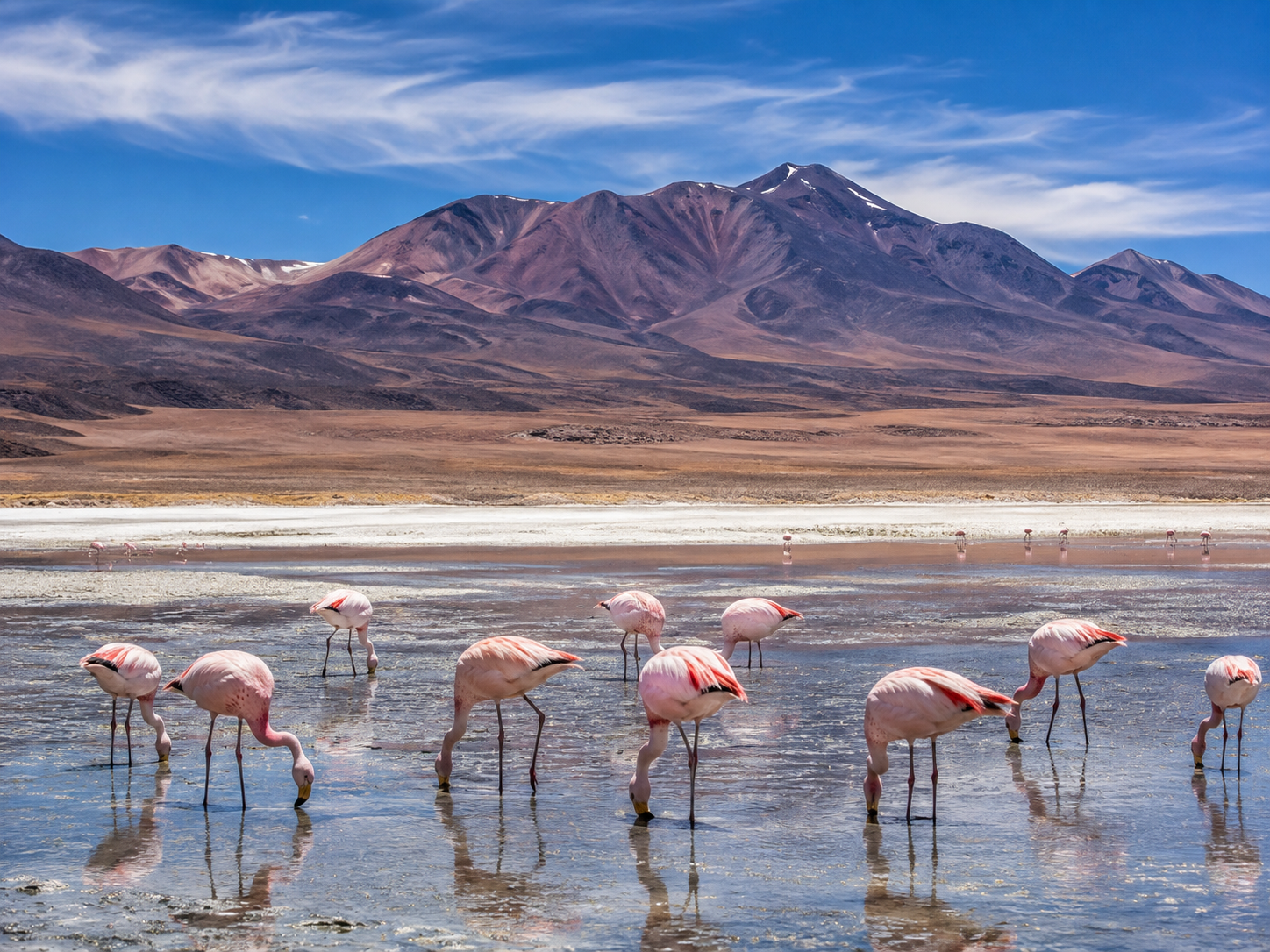
The most spectacular examples are not usually found on the salt crust itself, but in the lagoons and wetlands around the Salar, where high-altitude wildlife can find food and water.
Among the most recognizable are flamingos.
Several South American flamingo species use high-Andean lagoons in the wider Uyuni region, feeding on organisms such as algae and small aquatic invertebrates.
Their presence is a reminder that the Salar is not an isolated white desert.
It belongs to a much larger high-altitude ecosystem.
An Island in a Sea of Salt
Then there is Incahuasi Island.
Rising from the middle of the Salar, this rocky outcrop looks almost surreal against the surrounding white.
It is covered with enormous cardón cacti, including specimens that can reach several metres in height. Incahuasi is associated with the remains of an ancient volcanic formation that was once surrounded by prehistoric lake waters.
The contrast is striking.
White salt covers the horizon in every direction, while tall green cacti rise from the rocky ground.
It is one of the clearest examples of how life can occupy small pockets of very different environments within the wider Salar landscape.
The island also preserves evidence of the region's changing geological past.
What appears today as an isolated island in a salt desert was once part of a very different landscape.
People Have Lived With the Salt
The Salar is not simply a geological curiosity.
People live around it and have long made use of its resources.
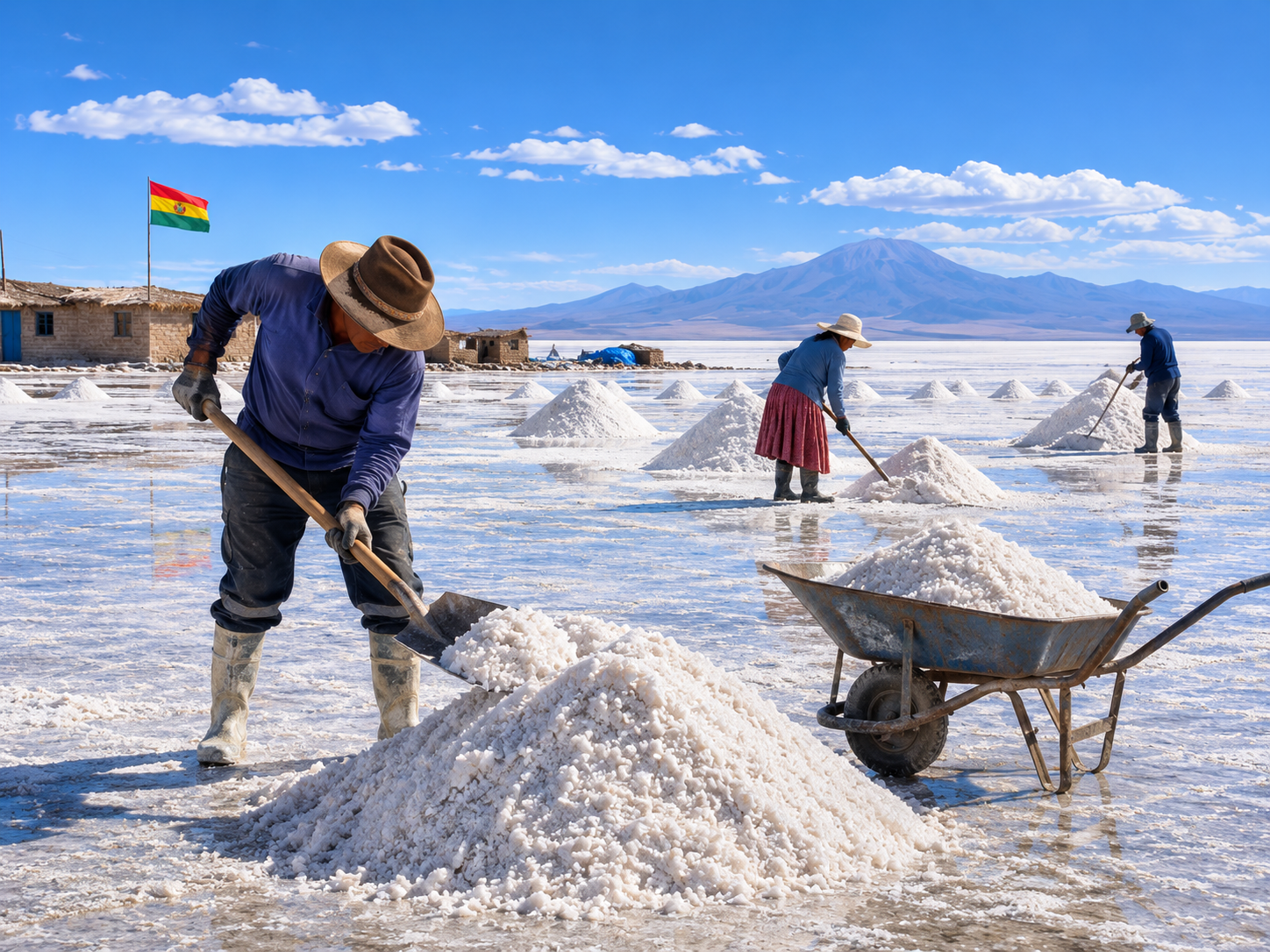
In communities around the salt flat, traditional livelihoods have included salt extraction, agriculture and camelid herding. The wider southern Altiplano also has strong Aymara and Quechua cultural traditions.
Near Uyuni, the community of Colchani is particularly associated with salt production.
Salt is collected from the crust, processed and sold for different uses.
The work connects the enormous natural landscape to everyday life.
For visitors, the Salar can seem almost alien.
For the people who live around it, it is also a workplace and a source of resources.
A Landscape Shared by Nature and People
The Salar's extreme environment does not mean it is empty.
Flamingos gather at nearby lagoons.
Cacti rise from rocky islands.
Communities harvest salt and maintain livelihoods around the margins of the flat.
And the surrounding Altiplano supports agriculture and livestock despite its harsh conditions. FAO documents long-established Aymara and Quechua agricultural communities in the southern Altiplano, including around the Uyuni region.
The Salar therefore tells two very different stories at once.
One is geological: water disappeared, minerals remained, and an enormous salt landscape formed.
The other is human and ecological: life adapted to the landscape rather than avoiding it completely.
But beneath the beautiful white surface is another resource that has brought the Salar into a very different global conversation.
Lithium.
The same landscape that looks almost empty from a distance is therefore full of different forms of life and human activity.
And beneath it lies a resource that could shape Bolivia's economic future.
Chapter 4 — The Resource Beneath the Beauty
The Salt Flat's Hidden Treasure
From the surface, Salar de Uyuni looks almost completely empty.
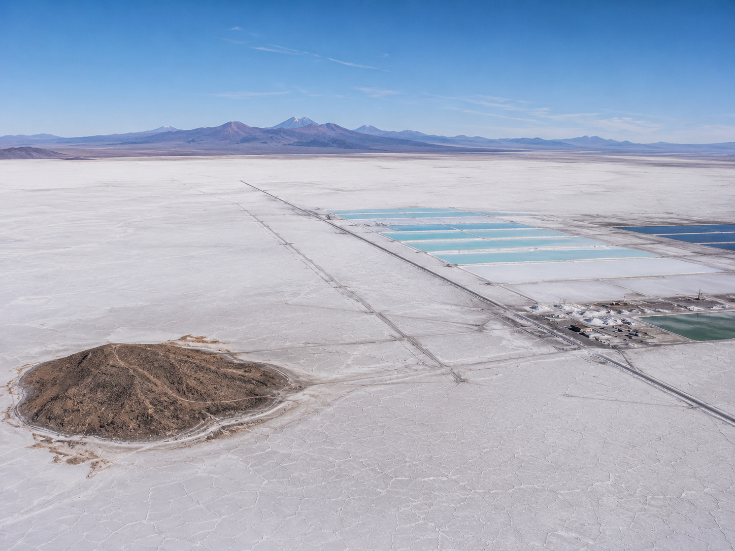
But beneath the white crust is a very different landscape.
Highly saline brines contain dissolved lithium, a metal used in rechargeable batteries and other technologies. Geological studies have documented lithium-rich brines beneath the Salar for decades.
Today, the scale of the resource is enormous. The 2026 U.S. Geological Survey estimates Bolivia has about 23 million metric tons of identified lithium resources. Importantly, that is a resource figure, not 23 million tons of proven economic reserves.
That distinction matters.
A resource represents material that may potentially be extracted; a reserve is the portion demonstrated to be economically recoverable under defined conditions.
So the often-repeated claim that Salar de Uyuni contains 50–70% of the world's lithium reserves should not be presented as a fact.
Why Lithium Matters
Lithium has become strategically important because of its use in rechargeable batteries.
That connects this remote Bolivian landscape to electric vehicles, portable electronics and energy-storage systems around the world.
For Bolivia, developing its lithium resources offers the possibility of creating a larger domestic industrial sector rather than simply exporting raw material.
The country has pursued state-led lithium development through Yacimientos de Litio Bolivianos (YLB) and has also explored direct lithium extraction technologies.
In 2025, YLB announced plans involving direct lithium extraction plants at the Salar de Uyuni.
But having a huge resource does not automatically make extraction easy.
Uyuni's brines have their own chemical characteristics, and turning lithium-rich brine into battery-grade material requires complicated processing.
The Environmental Question
This is where the story becomes complicated.
Lithium development could bring investment, employment and government revenue.
But the Salar exists in one of the world's driest high-altitude environments, where water is already an important resource.
Brine extraction and processing can alter the movement and balance of fluids within and around salt-flat systems. Researchers have raised concerns about brine pumping, freshwater interactions and the management of waste streams. A 2025 study specifically examining lithium-brine operations at Salar de Uyuni highlighted questions surrounding brine levels, adjacent freshwater and wastewater quality.
These concerns matter beyond the mining facilities themselves.
Communities around the Salar depend on water for agriculture, livestock and other livelihoods.
That creates a difficult question:
How much of the Salar can be developed without damaging the environmental systems and communities that already depend on it?
Two Futures for the Salar
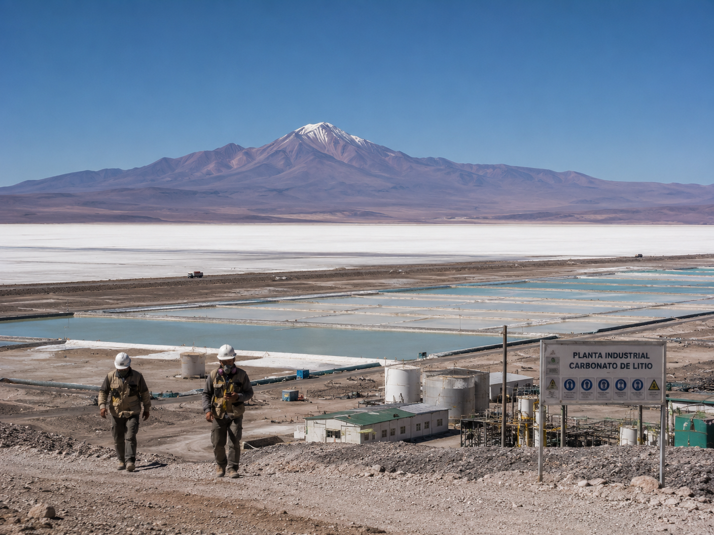
There is no simple answer.
From one perspective, lithium offers Bolivia an opportunity to participate in the rapidly growing battery economy.
From another, the Salar is an extremely unusual ecosystem and landscape whose water systems are not completely understood.
Bolivia's government argues that newer extraction technologies can allow the resource to be developed while managing environmental impacts. Independent researchers and local communities have continued to raise questions about water use, monitoring and long-term effects.
The debate is therefore not simply lithium versus nature.
It is about whether a valuable resource can be developed without undermining the landscape and communities that surround it.
A Resource Beneath a Natural Wonder
The contrast is striking.
Above the ground is one of Earth's most extraordinary landscapes.
Below it is a resource that could help supply a technology central to the modern energy transition.
That makes Salar de Uyuni more than a beautiful destination.
It has become a place where geology, economics, technology, water and local livelihoods meet.
The challenge is making sure that the pursuit of one resource does not permanently damage the landscape that made the Salar valuable in the first place.
Chapter 5 — Visiting Salar de Uyuni Today
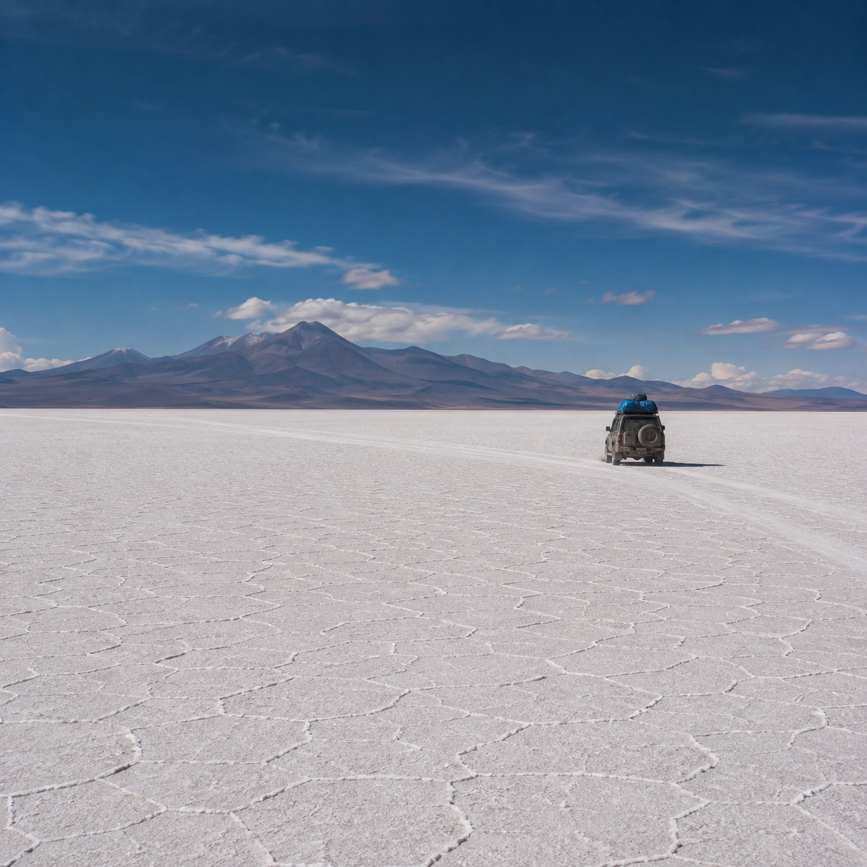
Stepping Onto the White Horizon
For visitors, Salar de Uyuni begins as a journey across Bolivia's high Altiplano.
The town of Uyuni is the main gateway to the salt flat, and organized 4×4 excursions commonly take visitors across the enormous expanse.
The experience changes dramatically with the season.
During the dry period, the landscape becomes a seemingly endless field of white salt, with its famous polygon patterns stretching toward the horizon.
After rain, parts of the Salar can transform into the reflective landscape that has made it famous.
But the mirror is never guaranteed.
Rainfall, water depth and local conditions determine where and when the effect appears.
And because the Salar sits at roughly 3,650 metres above sea level, visitors also have to deal with the realities of a high-altitude environment. Altitude sickness is a recognized risk in the Salar de Uyuni region.
The Photography Playground
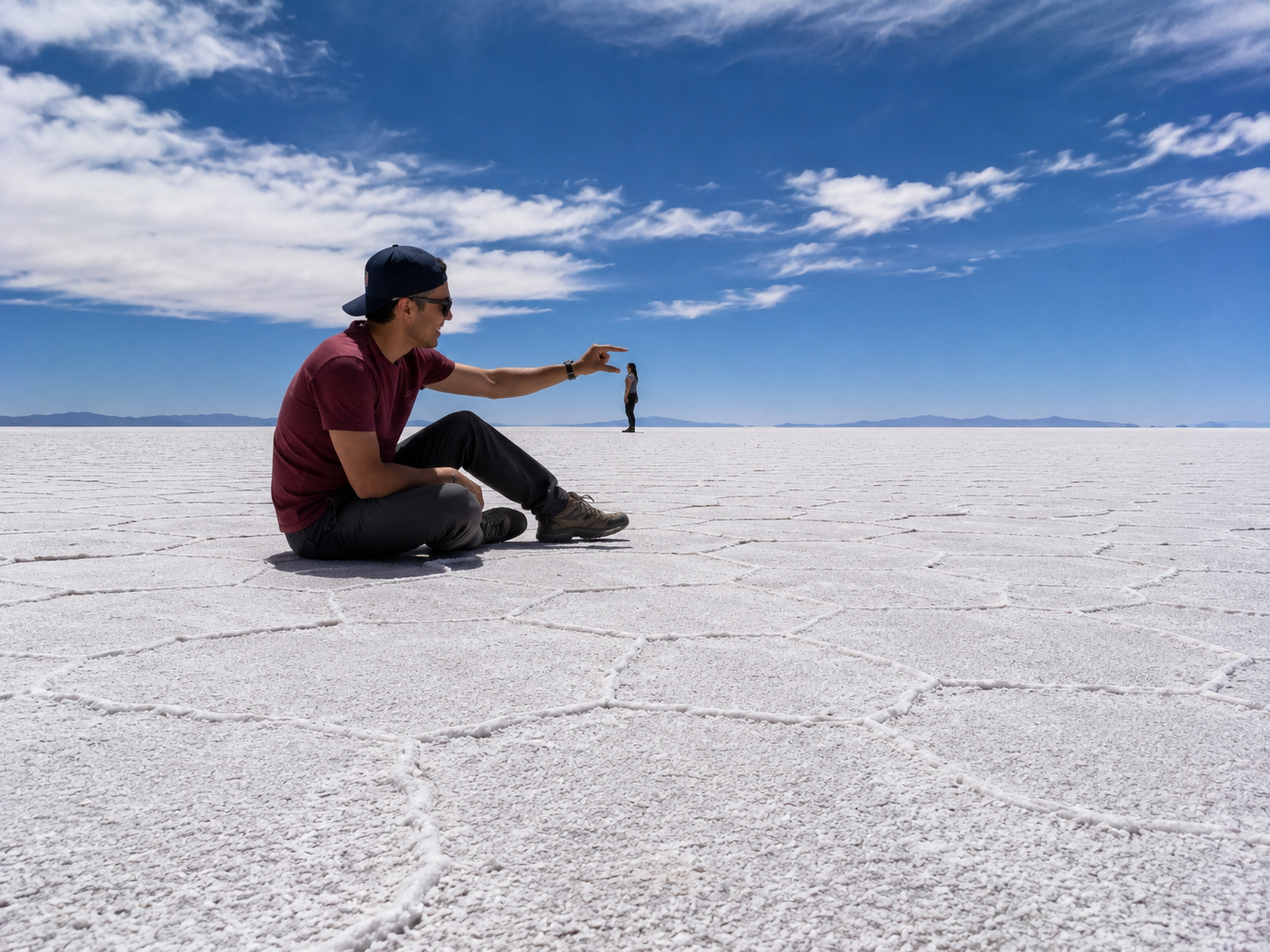
Few places make distance look so strange.
With an almost featureless horizon, photographers can use forced perspective to make people appear enormous or tiny, or position objects so they seem to stand on the horizon.
During the wet season, the effect becomes even more dramatic.
A shallow sheet of water can reflect the sky so completely that photographs appear to show people walking through the clouds.
But there is no trick in the landscape itself.
The extraordinary images come from a combination of scale, perspective, flatness and reflection.
A Beautiful Place With Real Limits
The Salar may look indestructible, but it is not.
Tourism brings income to communities around the region, but increasing visitation also creates pressure through vehicle traffic, waste and disturbance.
The wider Altiplano is also an environmentally sensitive, water-limited region.
That makes responsible tourism important.
Visitors should follow local guidance, avoid damaging the salt crust or vegetation, take waste with them and respect communities working around the Salar.
Current travel conditions can also change quickly. Bolivia can experience road blockades and difficult road conditions, while the rainy season can make some routes more difficult. Travelers should check current local conditions before setting out.
More Than a Perfect Photograph
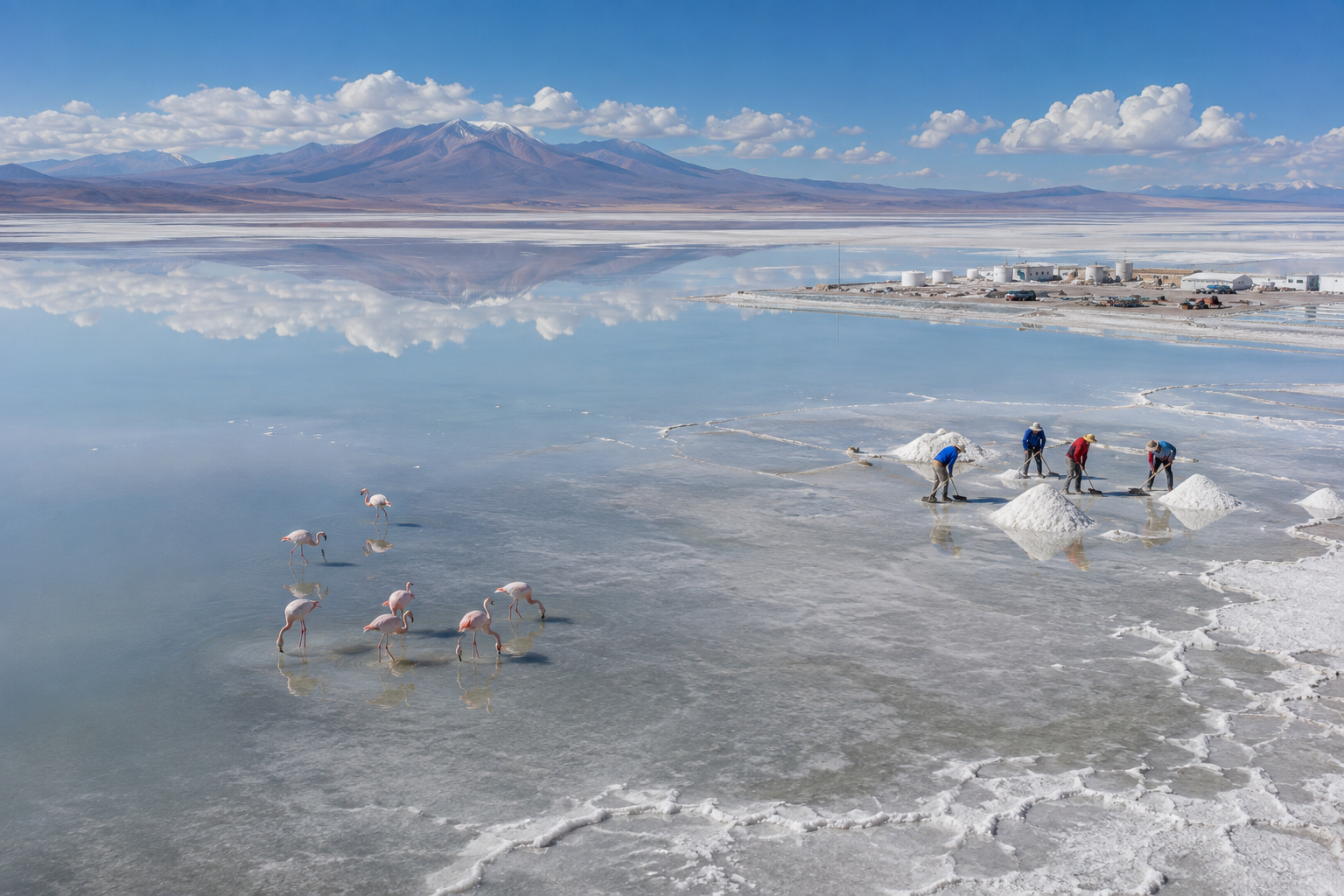
It is easy to remember Salar de Uyuni as a photograph.
A person standing beneath a reflected sky.
A white horizon disappearing into the distance.
A landscape that seems almost impossible.
But the photograph is only the final moment of a much longer story.
Ancient lakes helped shape the basin.
Evaporation left enormous mineral deposits.
Life adapted around the harsh landscape.
People learned to live and work with the salt.
And beneath the surface, lithium-rich brines have connected this remote landscape to the modern global economy.
The Salar is therefore not simply a place where the sky touches the ground.
It is a landscape where geology, life, people and modern industry meet.
And perhaps that is what makes it so remarkable.
The mirror may disappear when the water dries.
But the story beneath it remains.
Frequently Asked Questions — Salar de Uyuni
1. What is Salar de Uyuni?
Salar de Uyuni is the world's largest salt flat, covering roughly 10,000 square kilometres in southwestern Bolivia.
2. Why does Salar de Uyuni become a mirror?
During the wet season, a thin layer of water can spread across the exceptionally flat salt surface. When the water is calm, it reflects the sky and creates the famous mirror effect.
3. When is the best time to see the Salar de Uyuni mirror?
The mirror effect is most associated with the wet season, generally during the Southern Hemisphere summer. However, rainfall varies, so a perfect reflection cannot be guaranteed on every visit.
4. Is Salar de Uyuni made of real salt?
Yes. The white crust consists primarily of salt minerals formed through the evaporation of ancient water in the closed Altiplano basin.
5. How was Salar de Uyuni formed?
Its geological history involves ancient lakes, changing climate and repeated evaporation. As water disappeared, dissolved minerals accumulated and eventually formed the extensive salt deposits seen today.
6. Does Salar de Uyuni contain lithium?
Yes. Lithium-rich brines occur beneath the salt crust. Bolivia has one of the world's largest identified lithium resource estimates, although lithium resources and economically recoverable reserves are not the same thing.
7. Can you drive across Salar de Uyuni?
Yes. 4×4 vehicles are commonly used to travel across the salt flat, particularly because of its enormous size and difficult terrain.
8. What animals live around Salar de Uyuni?
Wildlife is concentrated mainly around the surrounding lagoons and Altiplano rather than the intensely saline salt crust. Flamingos are among the most recognizable animals in the region.
9. What is Incahuasi Island?
Incahuasi is a rocky island rising from the Salar de Uyuni. It is famous for its large cacti and provides a striking contrast to the surrounding white salt landscape.
10. Can people live on Salar de Uyuni?
The salt flat itself is not a conventional residential environment, but communities live around it and depend on the wider region for activities including salt harvesting, agriculture, livestock and tourism.
11. How high is Salar de Uyuni?
The Salar sits at approximately 3,650 metres (12,000 feet) above sea level, making altitude an important consideration for visitors.
12. Why is Salar de Uyuni important?
It is important for several reasons: its exceptional geological features, unique landscapes and ecosystems, local livelihoods, tourism, and its significant lithium resources.