Introduction — Where the Road Seems to Break the Rules
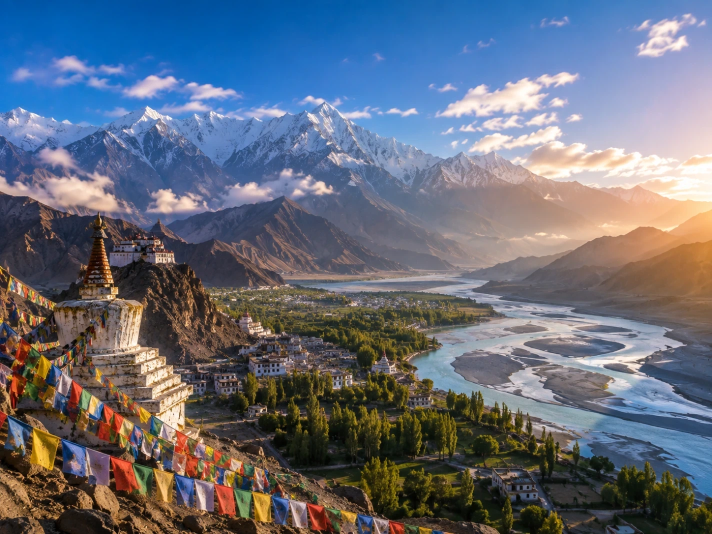
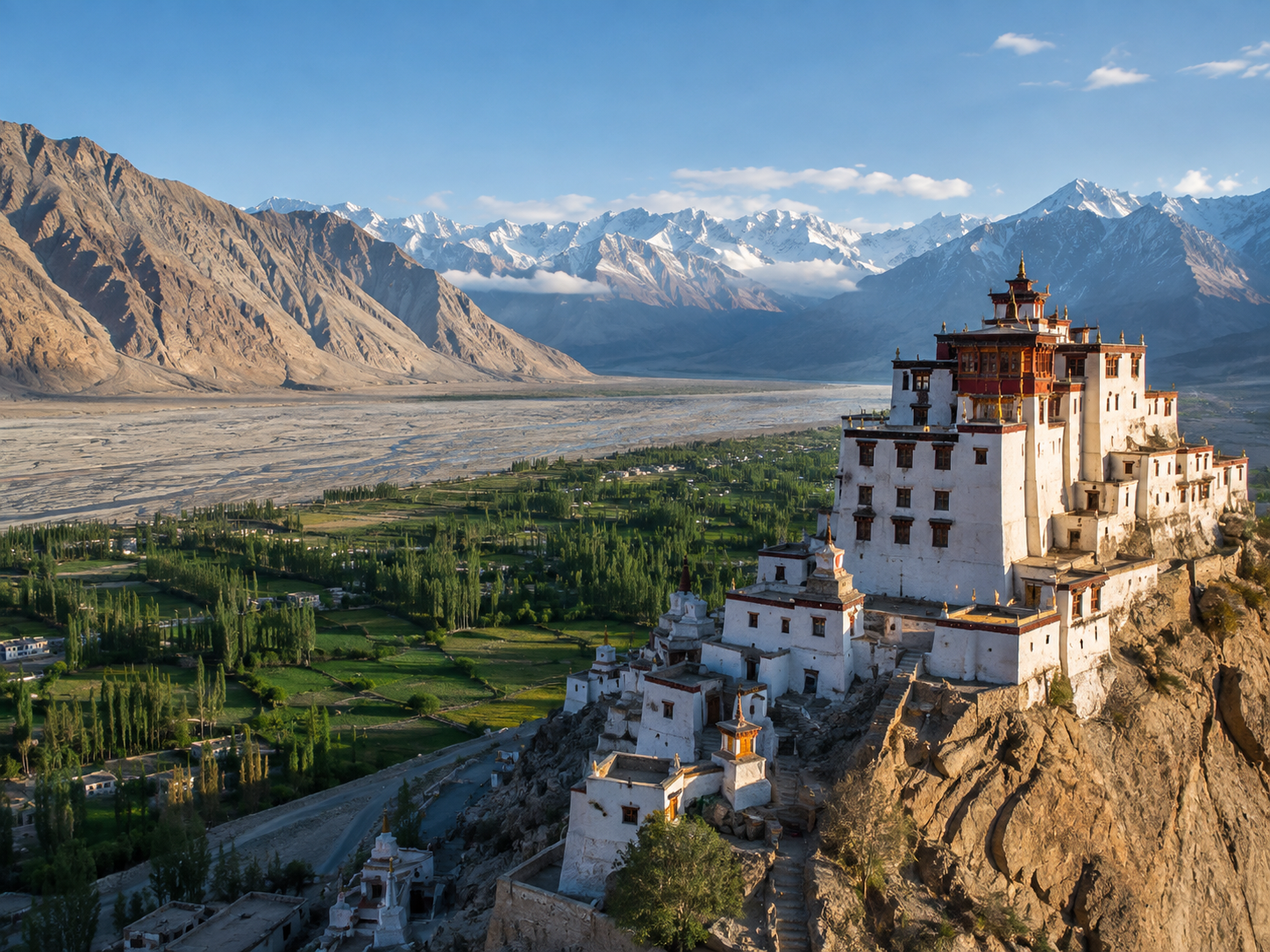
A white stupa stands above the valley, its prayer flags moving in the cold mountain wind.
Below it, a braided river cuts through a surprisingly green strip of land. Beyond the valley, enormous brown mountains rise toward a line of snow-covered peaks beneath a deep blue sky.
This is Ladakh.
It is one of the world's highest inhabited regions, where many valleys sit thousands of metres above sea level and where the landscape can change dramatically within a short distance.
The first impression can be confusing.
These look like Himalayan mountains, yet much of the land is dry and almost desert-like. Snow-covered summits rise above barren slopes. Rivers support narrow ribbons of vegetation. Ancient Buddhist monasteries occupy hillsides above settlements, while roads climb through some of the world's most demanding mountain terrain.
The reason is not mystery.
Ladakh lies in the rain shadow of the Himalayas, where the surrounding mountains block much of the moisture carried by the Indian monsoon. The result is a cold, high-altitude environment with little precipitation compared with the wetter regions farther south.
Yet life has adapted to it.
People cultivate narrow green valleys, livestock graze on high pastures, and wildlife such as the snow leopard survives among the mountains.
And scattered across this extraordinary landscape are places that can make Ladakh seem almost unreal—from a road that appears to run uphill to a lake whose colors shift with the changing light.
The journey begins with the landscape itself: a desert suspended high among the mountains.
Chapter 1 — A Desert in the Sky
A Landscape That Shouldn't Look Like This
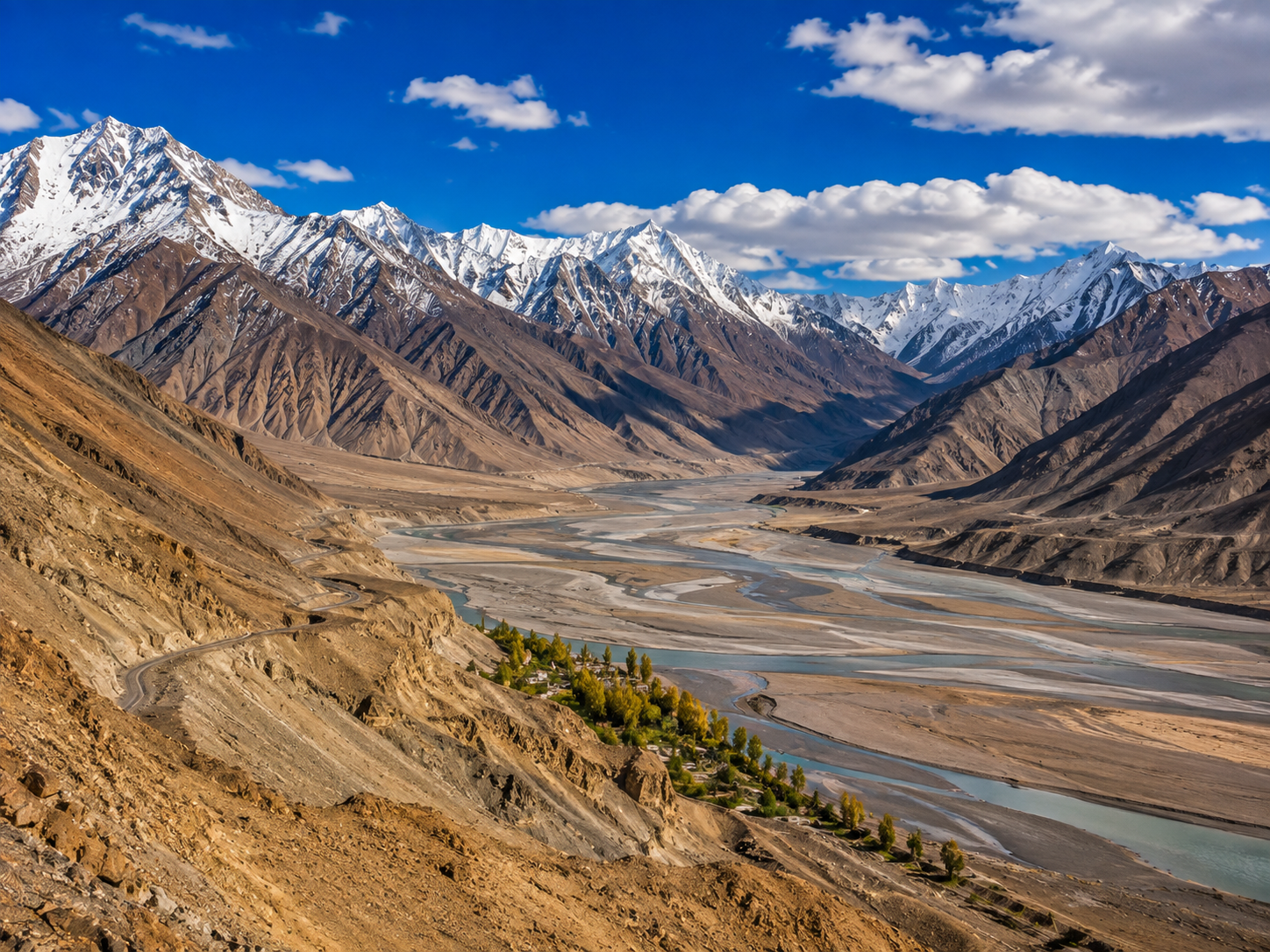
Look at the image of Ladakh and the contradiction is immediate.
Snow-covered mountains rise above a valley that looks almost completely dry. There are no dense forests covering the slopes. Instead, enormous stretches of brown and ochre rock are broken by narrow ribbons of green wherever rivers and irrigation provide enough water.
Ladakh is a high-altitude desert—a landscape shaped not simply by cold, but by a severe shortage of precipitation. The Himalayas form a climatic barrier that blocks much of the moisture carried by the Indian monsoon, leaving the region comparatively dry.
Why Is Ladakh So Dry?
The answer begins with geography.
Moist air from the Indian monsoon encounters the Himalayas and is forced upward. Much of that moisture falls on the southern side of the mountain system. By the time air reaches areas farther north, including Ladakh, it contains far less moisture.
This is known as a rain-shadow effect.
Ladakh's official disaster-management profile records very low annual precipitation in the Leh region, with an average of roughly 40–70 millimetres per year. Conditions vary considerably between valleys, so that figure should not be treated as a single rainfall value for the entire region.
That dryness explains the seemingly impossible combination of snow and desert.
Snow can accumulate on the high mountains while the lower valleys remain extremely dry.
And wherever meltwater reaches the valley floor, another landscape appears.
Green Exists Where Water Can Reach It
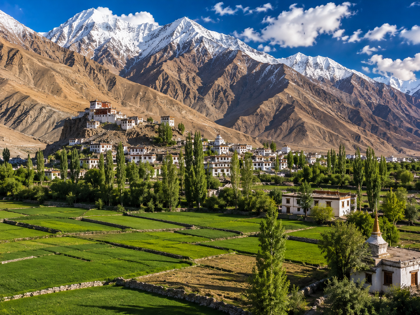
The brown mountains can make Ladakh look lifeless from a distance.
It isn't.
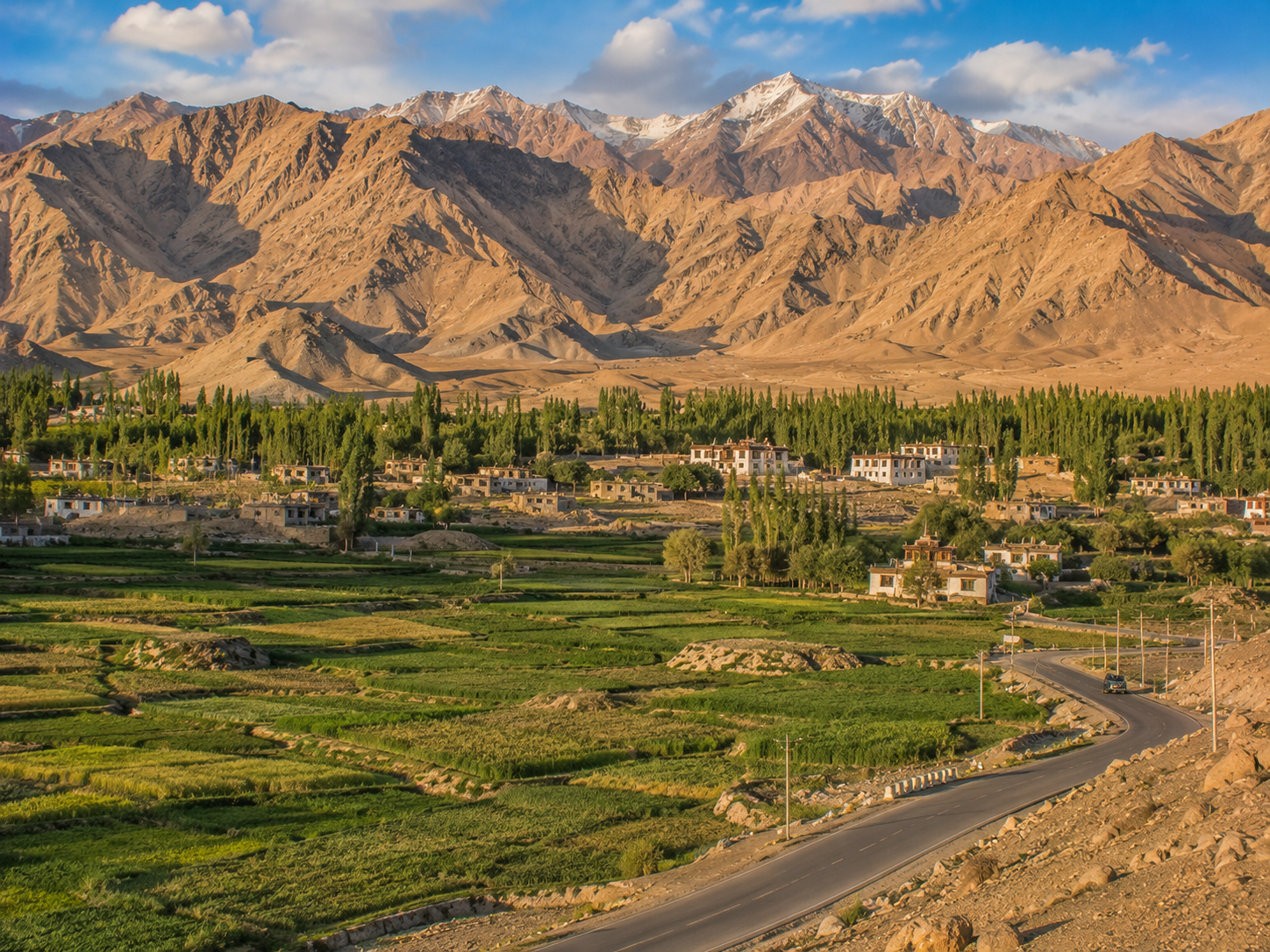
Settlements often appear as islands of green among the desert because water from rivers, streams and glacial or snowmelt-fed systems can be diverted for agriculture.
Leh's surrounding landscape, for example, contains irrigated fields and villages where vegetation contrasts sharply with the surrounding barren slopes.
This creates one of Ladakh's defining visual patterns:
brown mountains → blue river → green valley → white peaks.
The greenery isn't evidence that Ladakh is naturally a lush region.
It is evidence of where water is available.
High, Dry and Extreme
Altitude adds another layer to the environment.
Leh, Ladakh's principal urban centre, sits at roughly 3,500 metres above sea level, while many surrounding valleys and mountain passes rise considerably higher. The region's official sources describe Ladakh as a high-altitude desert, with much of the landscape positioned above 3,000 metres.
At these elevations, the atmosphere is thinner and weather can change rapidly. Ladakh also experiences strong temperature contrasts, particularly between intense daytime sunshine and cold nights.
That combination of altitude, dryness, intense sunlight and limited water has shaped almost everything here—from agriculture and settlement patterns to wildlife and traditional ways of life.
Ladakh may look empty.
But its landscape is telling us exactly where life is possible.
And soon, the road itself will appear to challenge what we think we see.
Chapter 2 — The Hill That Defies Gravity
When the Road Seems to Run Uphill
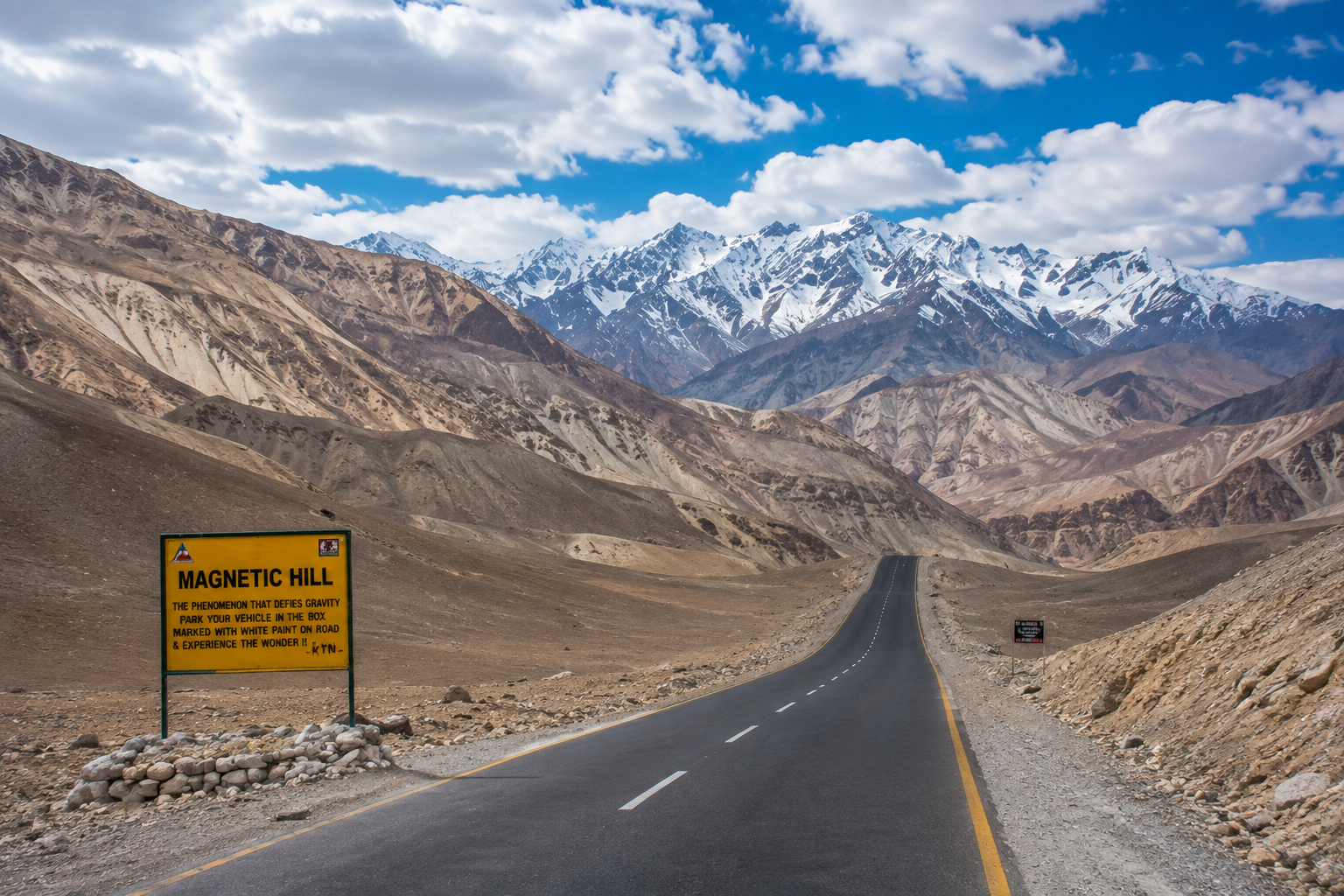
Park a vehicle on a particular stretch of road near Leh, switch off the engine, and something strange appears to happen.
The vehicle seems to roll uphill.
It is easy to understand why the place acquired the name Magnetic Hill. From the driver's position, the surrounding slopes and horizon can make the road appear to rise when it is actually descending.
There is no need for an invisible magnetic force.
The effect is an optical illusion created by the surrounding landscape and the road's visual gradient. The apparent horizon is difficult to judge accurately because the terrain around the road does not provide a normal level reference. India's official tourism material also describes the phenomenon as an optical illusion rather than genuine magnetism.
Your Eyes Are Making the Mistake
Normally, your brain uses the horizon and nearby objects to determine whether a road slopes upward or downward.
At Magnetic Hill, those visual cues can be misleading.
The surrounding mountains and uneven terrain interfere with the apparent horizon, making a slight downhill gradient look like an uphill one. When a vehicle is placed in neutral, gravity then pulls it down the actual slope—but your eyes interpret that movement differently.
The important distinction is:
The vehicle is moving downhill.
The landscape makes it look as though it is moving uphill.
This is why the phenomenon is better understood as a visual-gradient illusion rather than a magnetic anomaly.
Why Does It Feel So Convincing?
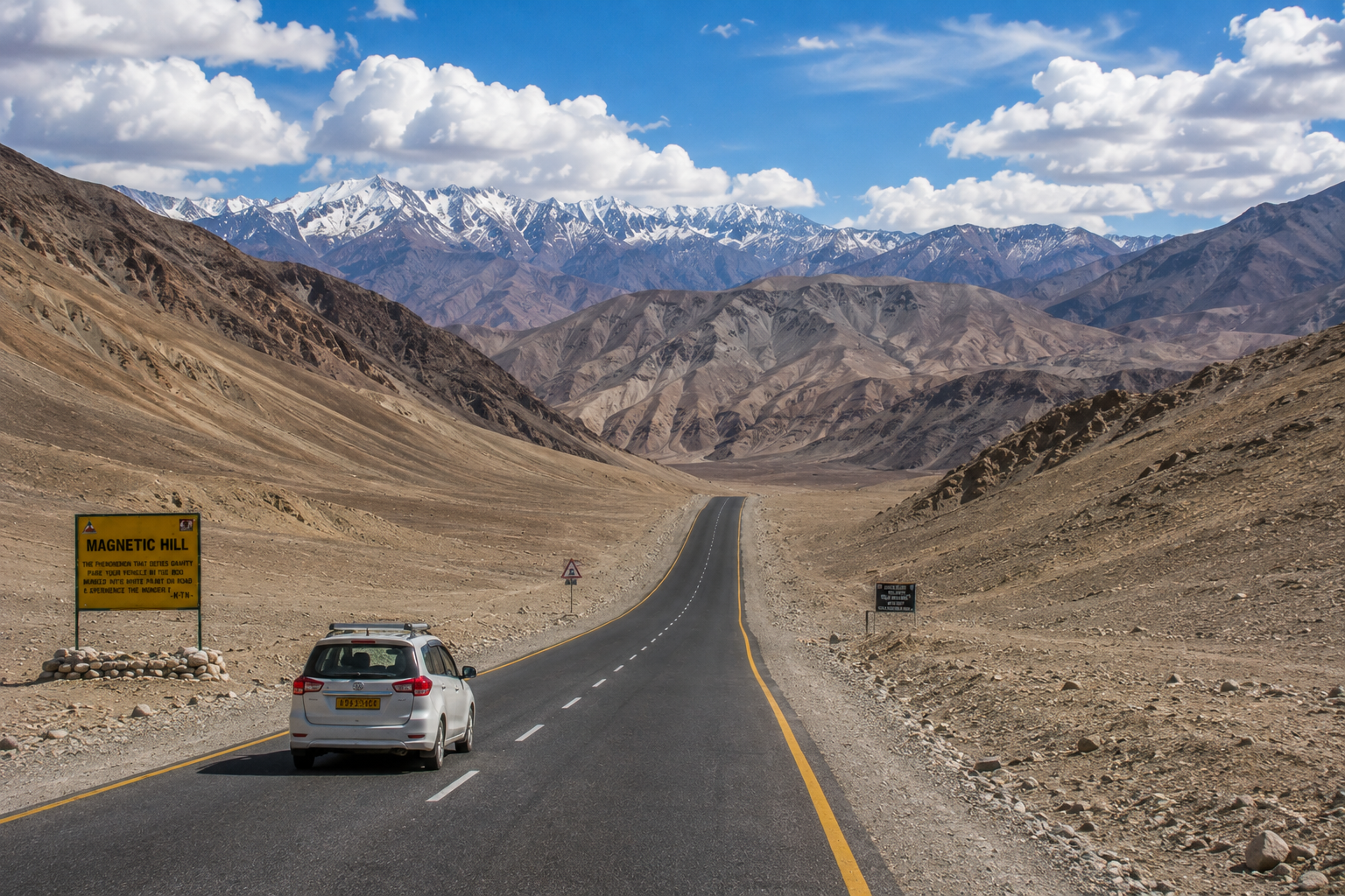
The illusion works because there is no obvious flat horizon against which to compare the road.
Instead, the road sits within a dramatic mountain landscape.
Your brain normally makes rapid judgments about orientation without consciously measuring the angle of the road. When the surrounding terrain provides misleading information, that judgment can be wrong.
The effect is similar to other gravity-hill illusions found around the world.
What makes Magnetic Hill particularly memorable is its setting.
A vehicle apparently rolling uphill, surrounded by enormous barren mountains, feels far more mysterious than the same illusion on an ordinary road.
Magnetic Hill Explained
So Magnetic Hill does not require a new law of physics.
It demonstrates something more interesting: our eyes can be remarkably confident—and completely wrong.
And once the road stops playing tricks, Ladakh has another surprise waiting: a lake whose surface can appear blue, green, grey or almost silver depending on the conditions.
Chapter 3 — A Lake That Changes Its Mind
The Color Is Never Quite the Same
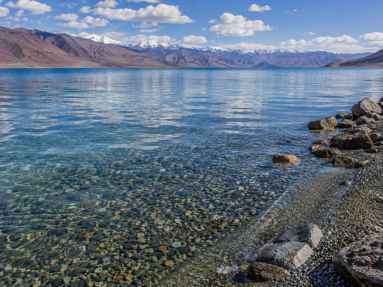
Pangong Lake can look blue in one moment and almost silver in another.
Under bright sunlight, parts of the lake may appear deep blue or turquoise. Later, as clouds move across the sky or the sun changes position, the same water can look darker, greyish or muted.
The lake isn't actually changing its chemical color.
Much of what we see comes from light, reflection, water depth, suspended material and the angle at which the lake is viewed. The surrounding mountains and sky also become part of the visual effect.
At roughly 4,225 metres above sea level, Pangong is already an extraordinary sight before its colors begin to change.
And there is another detail that makes the lake unusual.
It doesn't belong entirely to India.
Pangong Tso stretches for more than 130 kilometres across the Himalayan plateau, with roughly one-third in India and the remainder in China. The international boundary runs through the lake, although the exact boundary is not recognized in the same way by both countries.
Why Does Pangong Look Blue?
There isn't a single switch that makes the lake blue.
Water itself interacts with sunlight in complex ways. Some wavelengths of light are absorbed more strongly than others, while light is scattered and reflected from the water's surface. The sky is also reflected by the lake, especially when the surface is relatively calm.
That means what you see depends partly on the light arriving at the lake and the angle from which you are looking at it.
The surrounding landscape adds another layer.
Brown mountains, white snow, blue sky and the lake's own surface are all visible at the same time. As the sun moves across the sky, the balance between direct light, reflection and shadow changes.
Clouds can alter it again.
A section of the lake beneath a cloud can look considerably darker than water receiving direct sunlight only a short distance away.
So when two photographs of Pangong look dramatically different, that doesn't automatically mean one has been artificially colored.
They may simply have been taken under different conditions.
A Lake at 4,350 Metres
Pangong isn't impressive only because of its appearance.
It sits at roughly 4,350 metres above sea level, making it an extreme environment for both people and wildlife. The lake stretches for roughly 130 kilometres, extending from Ladakh into the Tibetan region administered by China. Official Indian sources describe approximately one-third of the lake as lying in India and the remaining portion in China.
It is also a brackish, endorheic lake.
That means water flows into the lake but does not drain outward to the sea through a conventional river system. Salts and other dissolved minerals therefore remain in the basin as water is lost through evaporation.
Despite being called a saltwater lake, Pangong can freeze completely during winter because of the extreme cold at this altitude. Ladakh Tourism specifically notes this seasonal transformation.
The summer landscape and winter landscape can therefore feel like two different places.
In warmer months, blue water sits between the mountains.
In winter, much of that water becomes ice.
The Mountains Make the Lake Look Even Larger
Pangong's scale is difficult to judge when you're standing beside it.
There are few trees and relatively few buildings around the open shoreline. The mountains rise directly from the surrounding landscape, creating an enormous visual frame around the water.
That emptiness matters.
At an ordinary lake, houses, roads and vegetation give your eyes familiar objects for judging distance.
At Pangong, those references are limited.
A mountain that appears close can be much farther away than it looks. The opposite shoreline can seem almost within reach even when it is separated by a vast body of water.
The result is a landscape where distance itself becomes difficult to judge.
And when the water is completely still, the effect becomes even stronger.
The mountains can appear reflected across its surface, visually extending the landscape downward.
It Is Not Entirely in India
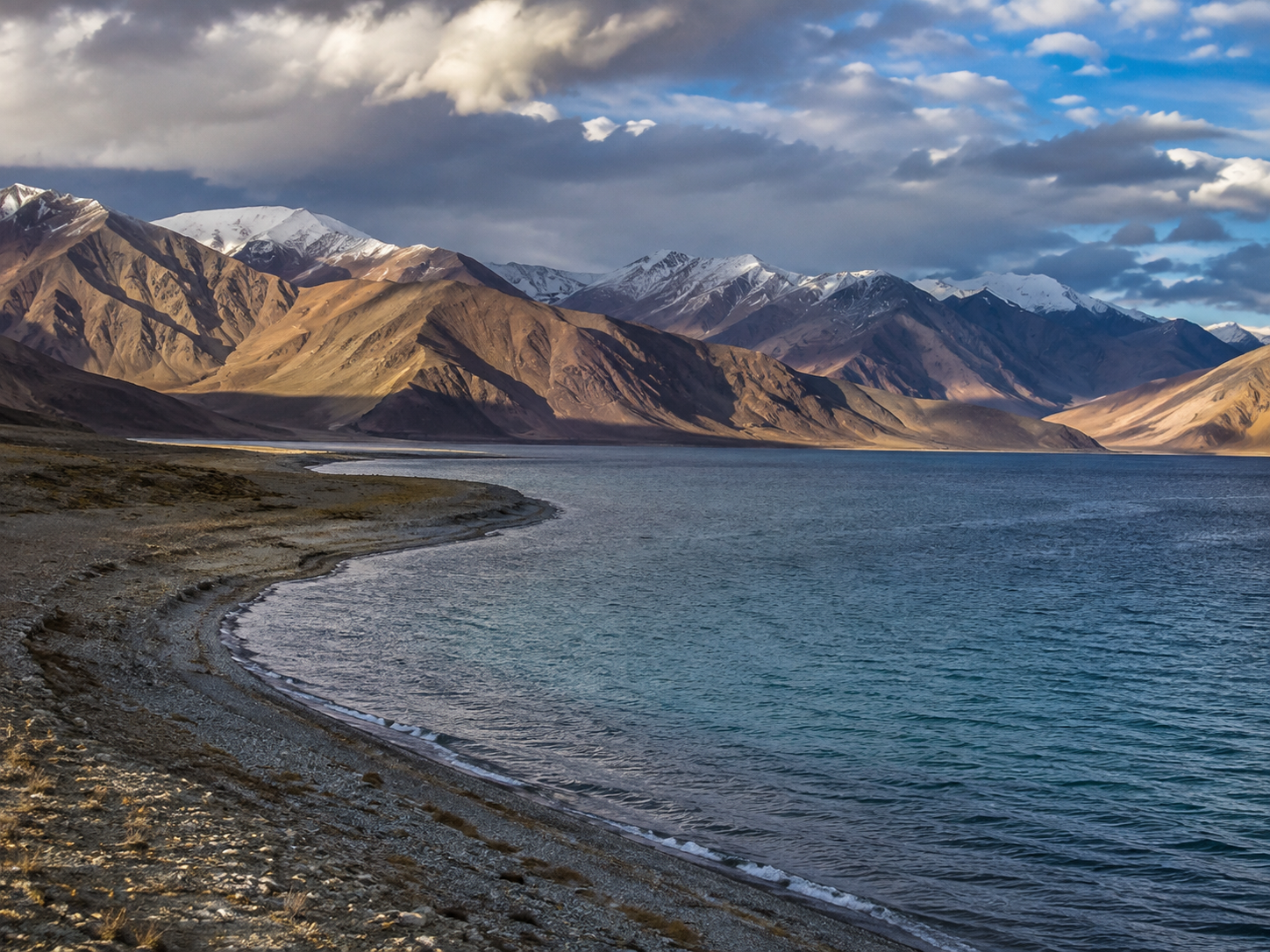
There is another reason Pangong is unusual.
The lake crosses an international boundary.
The Indian portion is accessible to visitors under the applicable regulations, while the lake continues eastward into territory administered by China. The border is not something a tourist can simply cross by following the shoreline.
From the Indian side, however, the geographical reality is easy to appreciate.
The lake keeps going.
The mountains keep going.
And beyond the part you can visit lies a much larger landscape that most visitors will never experience firsthand.
A Harsh Place That Still Supports Life
Pangong may look almost empty, but it isn't biologically lifeless.
The wider Pangong region provides habitat for high-altitude birds, including species such as bar-headed geese and black-necked cranes, which are among the birds associated with Ladakh's high-altitude wetlands.
The environment is demanding.
Cold temperatures, high elevation, strong sunlight and limited vegetation make survival difficult. Yet wetlands like Pangong provide resources that are scarce across the surrounding cold desert.
This is an important part of understanding Ladakh.
The dramatic scenery can make the region look empty.
But empty-looking does not mean lifeless.
When the Day Begins to Fade
Near sunset, the famous blue of Pangong can become less intense.
The mountains darken.
The surface of the lake begins reflecting the changing sky.
The sharp contrast between blue water and brown mountains gradually softens into darker shades.
Nothing supernatural has happened.
The lake hasn't suddenly transformed.
The light has changed, and our perception changes with it.
That is perhaps the more interesting explanation for Pangong's famous colors. The landscape doesn't need artificial enhancement or a mysterious mechanism to look extraordinary.
It already does.
And once the sun disappears behind the mountains, another part of Ladakh's character becomes visible—not in its lakes or deserts, but in the monasteries built into its mountainsides.
Chapter 4 — Monasteries Above the World
Where the Morning Begins With Bells
Before the roads fill with vehicles and visitors begin moving through the valleys, Ladakh's monasteries can feel remarkably quiet.
A prayer hall opens onto the cold morning air. Incense drifts through a doorway. Prayer flags move against a blue Himalayan sky. Somewhere inside, monks begin their daily religious routines.
These places are not simply monuments left behind by an earlier civilization.
They are living religious institutions.
Several of Ladakh's best-known monasteries—including Thiksey, Hemis and Diskit—remain active centres of Buddhist worship, education and cultural life.
Thiksey — A Monastery Above the Valley
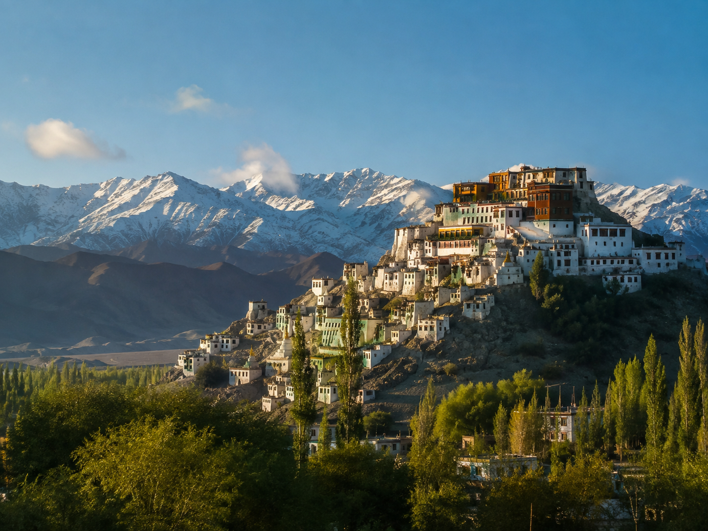
Thiksey is one of Ladakh's most recognizable monasteries.
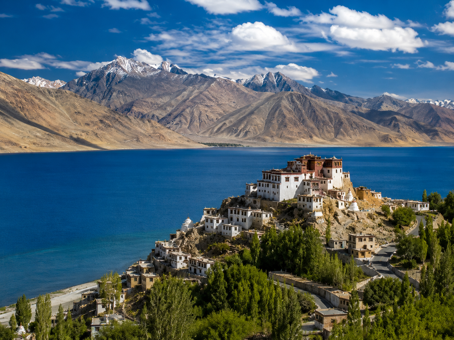
Its whitewashed buildings rise in tiers up a hillside, overlooking the Indus Valley. The complex dates to the 15th century and belongs to the Gelug tradition of Tibetan Buddhism. It remains an active religious centre with prayer halls, monks' residences and facilities for monastic education.
Its position is part of what makes it so striking.
Rather than sitting isolated from its surroundings, the monastery appears to grow directly out of the mountain above the settlement and agricultural landscape below.
From the higher parts of the complex, the valley opens into a broad panorama of fields, roads and mountains.
Inside, however, the atmosphere changes.
The bright landscape outside gives way to darker prayer halls containing Buddhist images, murals and ritual objects.
The contrast is part of the experience: a stark mountain desert outside, a carefully preserved religious world inside.
Hemis — A Different Setting
Further southeast of Leh is Hemis Monastery.
Hemis was founded in the 17th century and is associated with the Drukpa lineage of Tibetan Buddhism. It is regarded by Ladakh Tourism as the region's largest and wealthiest monastery, and is known for its collection of thangkas, murals and ritual artefacts.
Its setting feels different from Thiksey.
Instead of dominating a broad open valley from a prominent hilltop, Hemis is tucked into a more enclosed mountain environment.
The monastery is also known for the Hemis Tsechu, a religious festival featuring masked cham dances. These ceremonies are not simply performances for tourists; they form part of the monastery's religious and cultural traditions.
That distinction matters.
Ladakh's monasteries attract visitors because they are visually spectacular, but their primary purpose is religious, not tourism.
Diskit — Looking Across Nubra
More Than Beautiful Buildings
It is tempting to photograph Ladakh's monasteries purely as dramatic mountain architecture.
But doing that misses much of what makes them important.
Monasteries have historically been centres of religious practice, learning, art and community life. Their prayer halls, murals, manuscripts, statues and ritual objects preserve traditions that have developed across the Himalayan and Tibetan cultural world.
They also remain part of contemporary Ladakh.
Monks still live and study in these institutions. Religious festivals continue. Visitors arrive, but the religious life does not exist for the visitors.
That is why respectful behaviour matters when entering or photographing these places.
The silence of a monastery is not simply an aesthetic feature.
For many people there, it is part of worship
The monasteries reveal another side of Ladakh.
The mountains may dominate the photographs, but people have spent centuries building lives, communities and religious traditions within those mountains.
And then, farther north, the landscape changes again.
The valleys become wider, the vegetation thinner, and the desert begins to look strangely familiar.
There are sand dunes at the roof of the Himalayas.
Chapter 5 — Sand Dunes at the Roof of the World
A Desert Inside the Mountains
Nubra Valley does something that seems almost impossible at first glance.
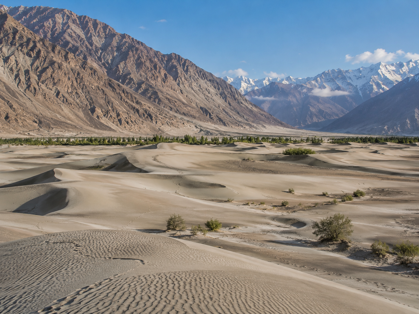
You can stand among sand dunes, look toward snow-covered mountains, and then see green fields and the Shyok River not far away.
This isn't a contradiction created by a tourist attraction. It is the actual landscape of the Nubra region.
Nubra is a broad valley shaped by the Nubra and Shyok rivers, surrounded by the rugged mountains of the Ladakh and Karakoram ranges. Around Hunder, the landscape becomes especially unusual: stretches of pale sand lie between the river plain and the mountains.
How Did Sand Dunes End Up Here?
The answer lies in Nubra's geography.
The valley is a large river plain, and its rivers have shaped and deposited sediments across the landscape over long periods. Around Hunder, wind and the local terrain have helped create areas of shifting sand.
This is not a giant desert like the Sahara.
The dunes occupy a relatively limited part of the valley, surrounded by rivers, vegetation, villages and enormous mountain slopes.
That is what makes the scene so unusual.
Within a relatively short distance, the landscape can change from green agricultural land to sandy terrain and then to bare mountains.
Ladakh Tourism describes Nubra as a cold-desert environment where green valley landscapes, rugged terrain and stretches of dunes occur together.
Then Come the Camels
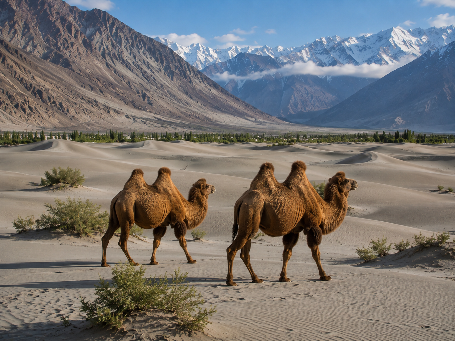
And then there is the animal that makes the landscape look even stranger.
The dunes around Hunder are associated with Bactrian camels—the distinctive two-humped camels of Central Asian origin.
Their presence isn't a random curiosity.
Nubra once formed part of important trans-Himalayan caravan routes connecting Ladakh with Central Asia. The camels found here are regarded as remnants of that historical trading world.
Their double humps are a genuine adaptation of the species, allowing them to store fat rather than water.
Today, the Bactrian camels around Hunder have also become part of the tourism economy, with camel rides offered in the dune area.
But the historical connection is more interesting than the tourist attraction.
For centuries, Nubra wasn't simply an isolated valley at the edge of the mountains.
It was connected to a much larger network of trade across Central Asia.
A Valley of Contrasts
Hunder becomes especially striking because the dunes aren't surrounded by endless sand.
Look beyond them and the scene changes again.
The Shyok River runs through the valley. Vegetation grows where water is available. Villages occupy parts of the valley floor. Behind everything rise steep, dry mountains.
That combination creates one of Ladakh's most distinctive landscapes:
sand + river + vegetation + mountains + snow.
It is also a useful reminder that calling Ladakh a “desert” does not mean every part of the region looks like a conventional desert.
A cold desert can contain rivers, cultivated fields, wetlands and even patches of trees.
The defining feature is the dry climate, not the complete absence of life.
Why Nubra Has Sand Dunes
The dunes are therefore not a mystery.
They are the product of geography, sediment, climate and wind—all operating in one extraordinary Himalayan valley.
From Trade Route to Tourist Destination
Nubra's history adds another layer to the landscape.
Caravans once travelled through this region carrying goods between Ladakh and Central Asia. Today, roads bring a very different kind of visitor: travelers arriving to see the monasteries, villages, rivers, mountains and dunes.
That transition has changed parts of Nubra's economy.
Hunder now has accommodation and tourism services, and the dunes have become one of the valley's best-known attractions.
Yet the landscape itself remains the real attraction.
At sunrise, the dunes catch warm light while the mountains behind them remain cool and shadowed.
For a moment, the valley looks like several different worlds occupying the same frame.
And perhaps that's the best way to understand Ladakh.
It isn't one landscape.
It is a collection of extremes sharing the same high-altitude space.
From here, we move beyond the scenery and toward the creatures that have learned to survive in it.
Chapter 6 — Life Where the Air Runs Thin
From a distance, much of Ladakh looks almost lifeless.
There are enormous stretches of bare rock, sparse vegetation and steep mountains where few trees can survive. Water is limited, winters are severe, and much of the region lies at elevations where the air contains considerably less oxygen than at sea level.
Yet animals live here.
Some have adapted to cold and altitude. Others have evolved ways of finding food across enormous, open landscapes where vegetation is scattered and seasonal.
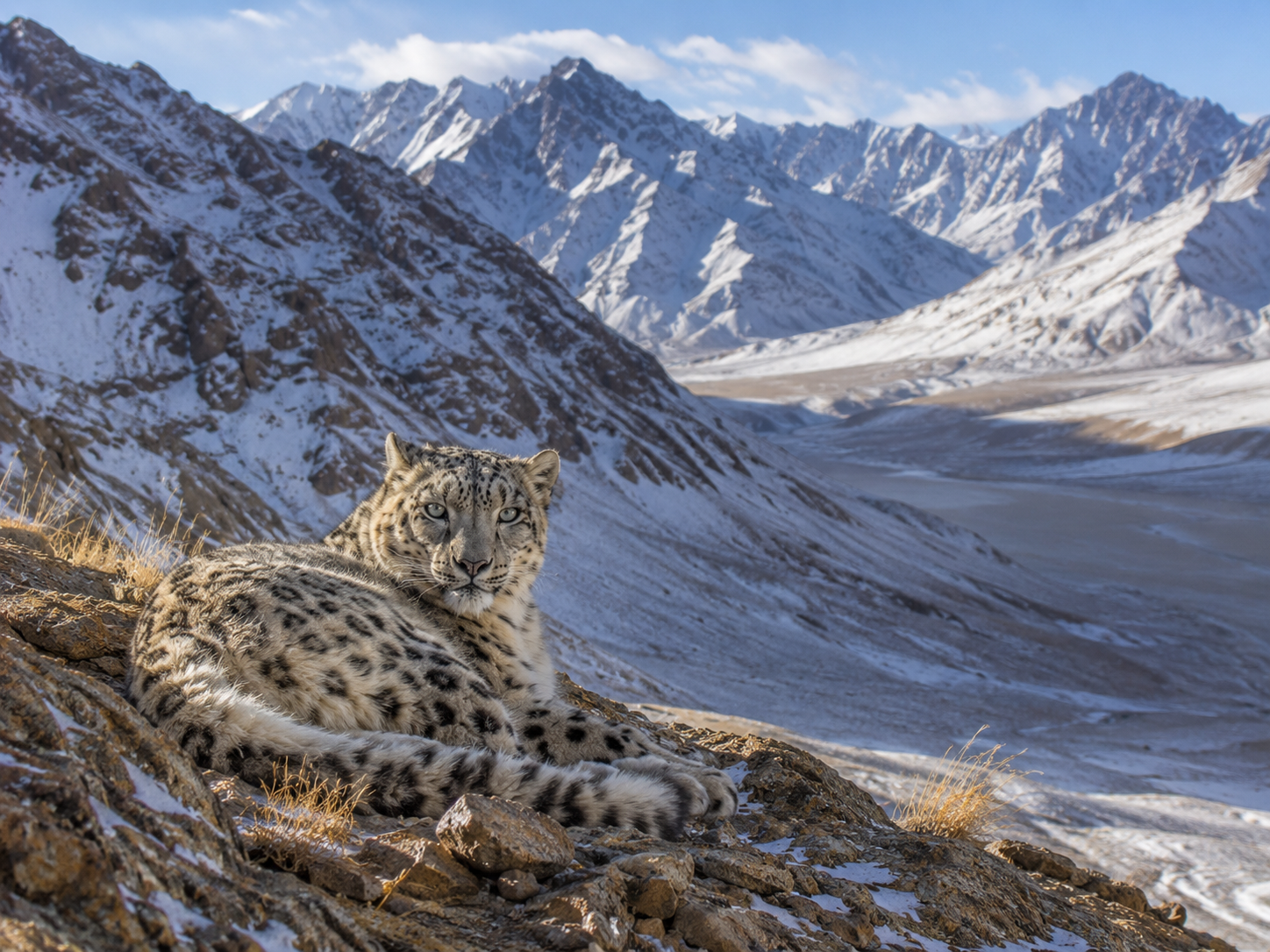
Among the most remarkable is an animal that can disappear into its surroundings so effectively that even experienced observers may spend hours looking for one.
The snow leopard.
Ladakh is one of its important habitats, particularly across high-altitude protected landscapes such as Hemis National Park. The Wildlife Institute of India describes Ladakh as a major part of India's snow-leopard range.
Built for a High-Altitude World
The snow leopard's environment is demanding, but the animal is adapted to it.
Its thick fur provides insulation against extreme cold. Its broad paws help distribute its weight across rocky and snowy terrain, while its long tail provides balance and can also be wrapped around the body for warmth.
But survival isn't simply about having the right physical features.
A predator also needs prey.
In Ladakh, snow leopards hunt animals including bharal, or blue sheep, and Asiatic ibex. These herbivores are themselves adapted to steep, rocky terrain, creating a predator-prey relationship that is closely tied to the mountain environment.
The result is an ecosystem where almost every advantage matters.
A mountain slope that looks barren to a visitor may contain enough vegetation to support herbivores—and those herbivores can support predators higher up the food chain.
Not Just Snow Leopards
Ladakh's wildlife extends far beyond its most famous predator.
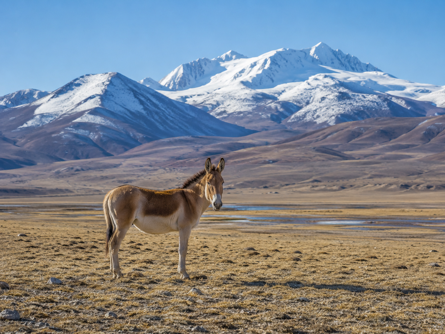
Protected areas across the region support bharal, Asiatic ibex, Ladakh urial, Tibetan wild ass or kiang, Tibetan gazelle, Tibetan wolf, Himalayan marmot and other high-altitude species.
In the Changthang region, the landscape becomes even more open.
Here, large plateaus and wetlands provide habitat for species such as the kiang, wild yak and the black-necked crane. The Changthang Wildlife Sanctuary is also important habitat for migratory and resident high-altitude birds.
The black-necked crane is particularly significant.
It is Ladakh's state bird, while the snow leopard is its state animal—a useful reminder that Ladakh's identity is tied not only to mountains and monasteries, but also to its wildlife.
Ladakh's High-Altitude Food Web
People and Wildlife Share the Same Mountains
Wild animals aren't the only ones adapting to this environment.
People have lived across Ladakh's high valleys and plateaus for generations, raising livestock and cultivating land where water is available. In some areas, livestock and wild predators occupy overlapping landscapes.
That can create conflict.
Snow leopards and other predators may occasionally kill domestic animals, creating an economic cost for households that depend on livestock. Ladakh's Forest, Ecology and Environment Department currently uses measures including predator-proof corrals, compensation for livestock losses and rapid-response support as part of its human-wildlife conflict mitigation work.
Conservation here therefore isn't simply about protecting animals from people.
It also involves finding ways for people and wildlife to continue sharing the same landscape.
That distinction matters.
A successful conservation strategy has to work for the ecosystem and for the communities living within it.
A Species We Still Know More About Every Year
The snow leopard is famous for being elusive, but scientists are gradually learning more about where it lives and how it uses the landscape.
India's first systematic nationwide snow-leopard assessment, conducted between 2019 and 2023, estimated 718 snow leopards in India, with about 477 in Ladakh. This is an estimate from a scientific assessment—not a literal count of every animal.
That distinction is important because wildlife populations are difficult to measure in remote mountains.
Researchers use methods such as camera traps, field signs, spatial surveys and other forms of ecological monitoring to estimate distribution and abundance.
The picture is therefore still developing.
Ladakh isn't a wilderness untouched by people.
It is a high-altitude ecosystem where wildlife, livestock, villages and conservation efforts overlap.
And perhaps that is the most remarkable part.
The landscape that first appears empty is actually full of relationships—between water and agriculture, mountains and wildlife, people and predators.
Soon, those relationships meet another force that is reshaping Ladakh itself:
tourism.
Chapter 7 — Ladakh Today
A Place That Is No Longer So Far Away
There was a time when reaching Ladakh itself was part of the adventure.
Today, roads, flights, hotels and tourism infrastructure have made many of its famous landscapes considerably easier to reach. Leh has become the main gateway for travelers heading toward places such as Nubra, Pangong and the high mountain passes.
But easier access has created a new question:
How much tourism can a fragile high-altitude landscape handle?
Ladakh's tourism industry is growing. Official figures show 117,546 tourist arrivals between January and May 2026, compared with 81,827 during the same period in 2025—a 43.6% increase.
That growth brings income and employment to communities involved in accommodation, transport, food, guiding, handicrafts and other services.
But it also puts pressure on resources that are already limited.
When Should You Go?
For most travelers seeking Ladakh's famous roads, lakes, valleys and monasteries, the main travel season is the warmer part of the year.
Summer offers relatively accessible roads and the clearest opportunity to visit many high-altitude destinations. Conditions, however, vary considerably between locations and routes.
Winter is a completely different experience.
Temperatures drop sharply, some routes become difficult or inaccessible, and many tourism services operate differently. At the same time, winter creates landscapes that summer visitors never see—snow-covered valleys, frozen lakes and dramatically quieter settlements.
Ladakh's administration is increasingly promoting year-round tourism, rather than concentrating visitors almost entirely into the traditional peak season.
So there isn't one universally "best" month.
It depends on what you actually want to see.
The Roads That Reach the Sky
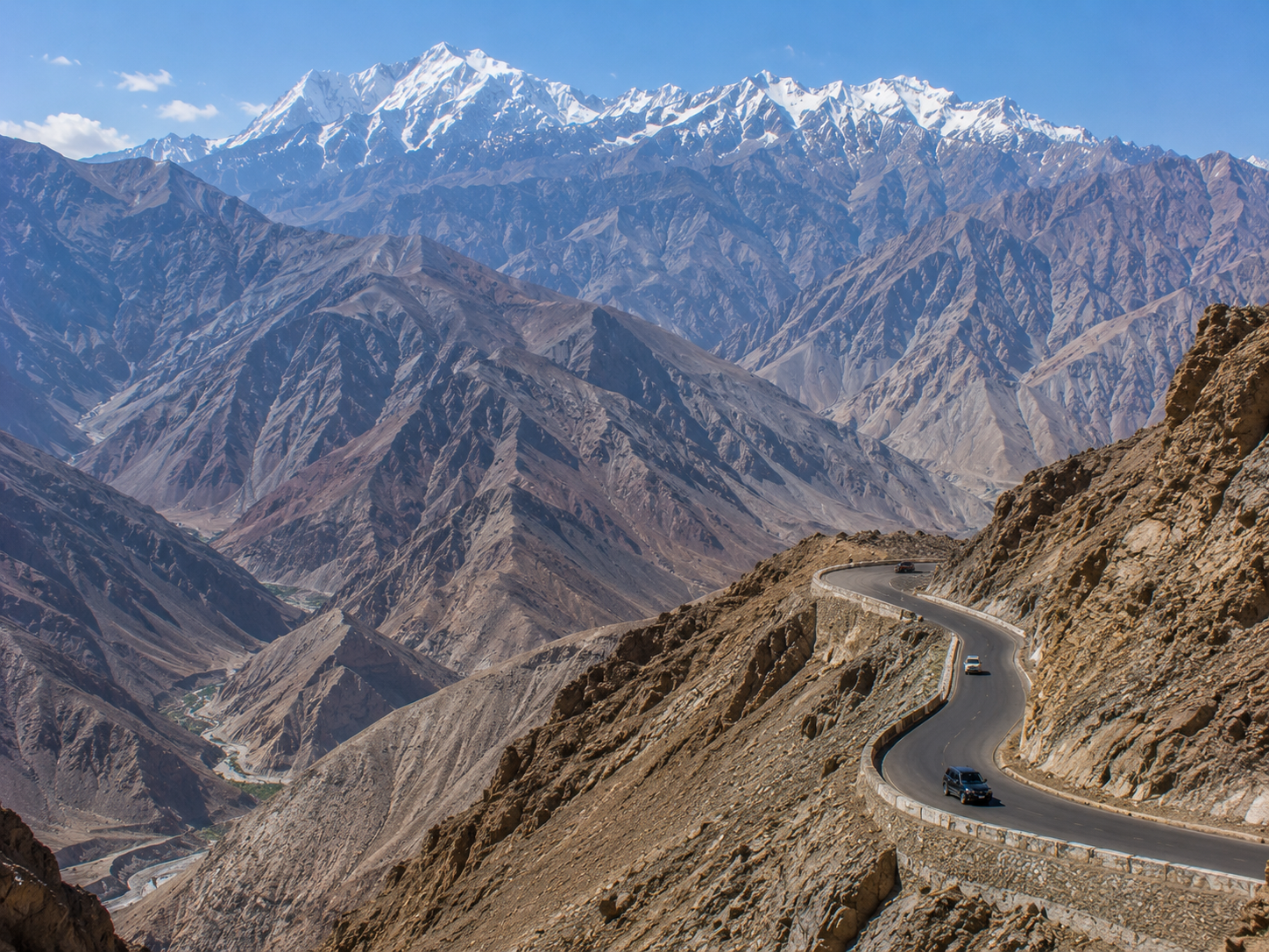
Ladakh's roads have become part of its identity.
Mountain passes connect valleys that were once extremely difficult to reach. Among the most famous is Umling La, which Ladakh Tourism currently lists at about 19,024 feet (5,798 m) and describes as the world's highest motorable pass.
But altitude records can be surprisingly complicated because different sources sometimes use different definitions of a "motorable road," "pass" or "road."
The important point is simpler:
Ladakh contains some of the highest roads regularly reached by motor vehicles anywhere on Earth.
And driving there isn't ordinary mountain driving.
At these elevations, weather can change quickly, oxygen is scarce, and distances between settlements can be substantial.
The spectacular road photographs therefore represent more than scenery.
They also represent the engineering effort required to connect communities across one of the world's most difficult terrains.
The Cost of Becoming Popular
Tourism is important to Ladakh's economy, but growth isn't without consequences.
Water is one of the clearest examples.
Ladakh is naturally dry, and its settlements depend heavily on limited water resources. An official 2024 regulation on hotel wastewater notes that growing tourism is increasing pressure on water resources and that wastewater management is an important environmental concern.
Tourism also creates challenges involving:
- waste and sewage management
- pressure on water supplies
- traffic and infrastructure
- disturbance in fragile ecosystems
- pressure on wetlands and wildlife habitats
Ladakh's environmental authorities specifically identify the need to balance tourism, grazing pressure and fragile ecosystems, particularly in places such as Changthang.
This doesn't mean tourism is inherently damaging.
It means the scale and manner of tourism matter.
A guesthouse can provide an important local livelihood.
A visitor can support a village economy.
A well-managed tourism system can help preserve cultural traditions.
But the same industry can become a burden if infrastructure grows faster than the environment can handle.
Ladakh's Tourism Balance
Ladakh Is Changing
Back to the Beginning
Remember the traveler from the beginning?
Standing on a mountain road, watching a car appear to roll uphill.
Looking across Pangong Lake as its color shifts with the light.
Walking through a monastery above the valley.
Finding sand dunes beneath snow-covered mountains.
Searching the rocks for an animal almost perfectly adapted to disappear into them.
At first, Ladakh seems like a place where the rules don't quite work.
A desert has rivers.
A lake changes color.
A monastery seems to grow out of a mountain.
Sand dunes appear beneath the Himalayas.
And animals survive where the air is thin and the landscape looks almost empty.
But none of these things require magic.
They are the result of geography, climate, geology, biology and centuries of human adaptation.
That may be the most interesting thing about Ladakh.
You don't have to make it more extraordinary than it already is.
The real landscape is enough.
FAQ — Ladakh: The Land Above the Clouds
1.Why does Magnetic Hill make cars roll uphill?
Magnetic Hill does not appear to have a proven magnetic force pulling vehicles uphill. The phenomenon is generally explained as a visual illusion: the surrounding terrain and apparent horizon can make a slight downhill slope look as though it rises. The vehicle is still responding to gravity.
2.Why does Pangong Lake change color?
Pangong can appear different shades of blue, green and other tones as lighting and viewing conditions change. Reflection from the sky, the angle of sunlight, water conditions and the surrounding landscape all contribute to how its color appears. The Ladakh administration specifically notes its changing colors.
3.How high is Ladakh above sea level?
Ladakh covers a large elevation range, so there isn't one altitude for the entire region. Leh is around 3,500 metres above sea level, while some mountain passes and peaks rise much higher. The UT administration gives Ladakh's overall elevation range as approximately 2,550–7,742 metres.
4.What is the best time to visit Ladakh?
It depends on what you want to experience. The warmer months generally provide easier access to many roads, valleys and high-altitude attractions, while winter brings snow, frozen landscapes and much harsher conditions. Ladakh is also increasingly promoting year-round tourism, so there isn't one universally correct travel season.
5.Are there really sand dunes in Ladakh?
Yes. Hunder in Nubra Valley has genuine sand dunes. They occur within a broader cold-desert valley alongside rivers, vegetation and enormous mountains. The combination of dunes and snow-capped Himalayan peaks is one of Nubra's most distinctive landscapes.
6.Are Bactrian camels native to Ladakh?
The two-humped Bactrian camels found around Hunder are associated with the region's historic Central Asian caravan trade. Their presence is linked to the old trade routes that passed through Nubra rather than being evidence that Ladakh naturally evolved as a camel habitat.
7.Is Pangong Lake entirely in India?
No. Pangong Tso extends across the India–China border. The Ladakh administration states that roughly one-third lies in India and two-thirds in China.
8.Is Ladakh completely barren?
No. Ladakh is a high-altitude cold desert, but its valleys contain rivers, agricultural fields, wetlands, villages and patches of vegetation. Water availability is one of the main factors determining where vegetation and settlements can thrive.
9.Can tourists drive anywhere in Ladakh?
No. Access and movement are subject to local regulations, and environmentally sensitive areas require particular care. In 2026, Ladakh authorities began imposing penalties for illegal off-roading in protected areas, including around Pangong Lake and wildlife habitats.
10.Why is Ladakh called a high-altitude desert?
Because it combines very high elevation with a dry climate and sparse vegetation. The Himalayas create a rain-shadow effect that limits moisture reaching much of the region, while the high elevation produces harsh temperatures and conditions.